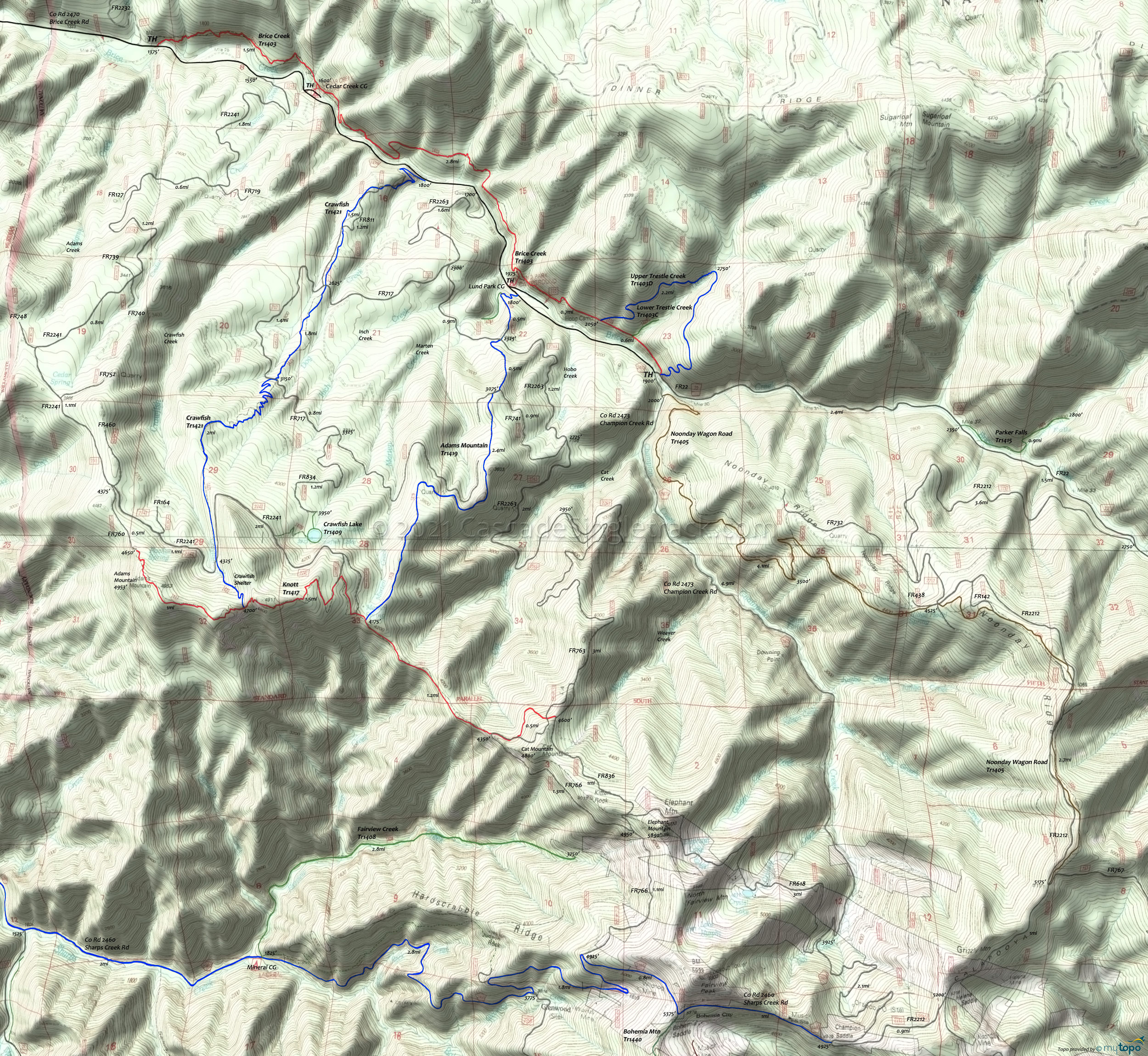
Crawfish Trail Area Mountain Biking and Hiking Topo Map
Map includes: Adams Mountain Trail 1419, Brice Creek Trail 1403, Crawfish Trail 1421, Knott Trail 1417, Upper Trestle Creek Trail 1403D Mountain Biking and Hiking Trails.
TH: Right from the TH, Crawfish Tr1421 is a relentless climb, paralleling Dog Creek to the upper ridgeline. Pass FR019 on the right at .47mi, then cross FR717 at 1.37mi and 2.1mi. Nearly to the top of Adams Mountain ridge, cross FR2241 at 3.85mi as the trail briefly levels off before the final ridgeline ascent to Knott Tr1417 at 4.3mi. After passing the Crawfish Shelter at 4mi, go left onto Knott Tr1417 at 4.3mi, then reach the ride summit at 4.5mi.
4.5mi: Moderate switchback descent from the summit to the FR2241 intersection at 5.7mi, followed immediately by the Adams Mountain Tr1419 intersection. There is an option to backtrack on FR2241 to visit Crawfish Lake.
5.77mi: Go left onto Adams Mountain Tr1419, with the edge of the first ridgeline at 6.3mi and the second descent starting at 7.5mi, leading to a very steep downhill ride to Lund Park campground. Pass FR741 at 8.1mi and FR2263 at 8.6mi, followed by a brief section of FR127 doubletrack before the trail narrows to singletrack for the final switchback plunge to FR22..
9.2mi: Go left on FR22 and head back to the trailhead.
Draggable map: Map window adjusts to screen size and will respond to touch control. Use scrollbar for mouse control.
No Map? Browser settings and some browser extensions can prevent the maps from appearing. Please see Site Tech


