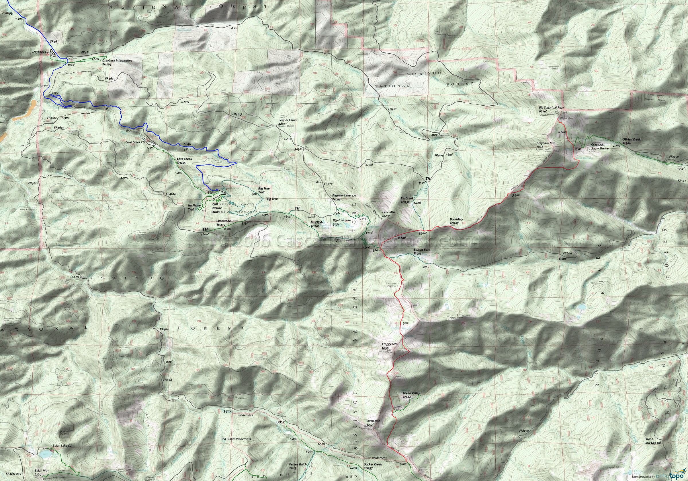
Mt Elijah Tr1206 Mountain Biking and Hiking Topo Map
Map includes: Mount Elijah Trail 1206, Boundary Trail 1207, Limestone Trail 1235, OBrien Creek Trail 900, Elk Creek Trail 1230, Sturgis Fork Trail 903, Bigelow Lake Trail 1214, Grayback Interpretive Trail 1204, Cave Creek Trail 1205, Cliff Nature Trail, Big Tree Trail Mountain Bike and Hiking Trails.
TH: Ascend or hike-a-bike from the Bigelow Lake Tr1214 TH (5633') for 1mi (6300'), then descend to Mt Elijah Tr1206 (6175').
1.3mi: Go left onto Mt Elijah Tr1206 and switchback to Boundary Tr1207 (5750').
2.1mi: Ascend 0.8mi to Elk Creek Tr1230 intersection (5900'), followed by a steep ascent to 6400'. Descend to a meadow at 5930', followed by a steep ascent to 6300'.
6.5mi: Having ridden off the ridgeline, pass the OBrien Creek Tr900 TH at 6200' and continue 0.6mi to the Windy Gap ride summit at 6500'.
7.2mi: At Windy Gap, return to the TH, or continue past the Mt Elijah Tr1206 intersection for 2.5mi to Craggy Mountain, then return to the TH.
Draggable map: Map window adjusts to screen size and will respond to touch control. Use scrollbar for mouse control.
No Map? Browser settings and some browser extensions can prevent the maps from appearing. Please see Site Tech


