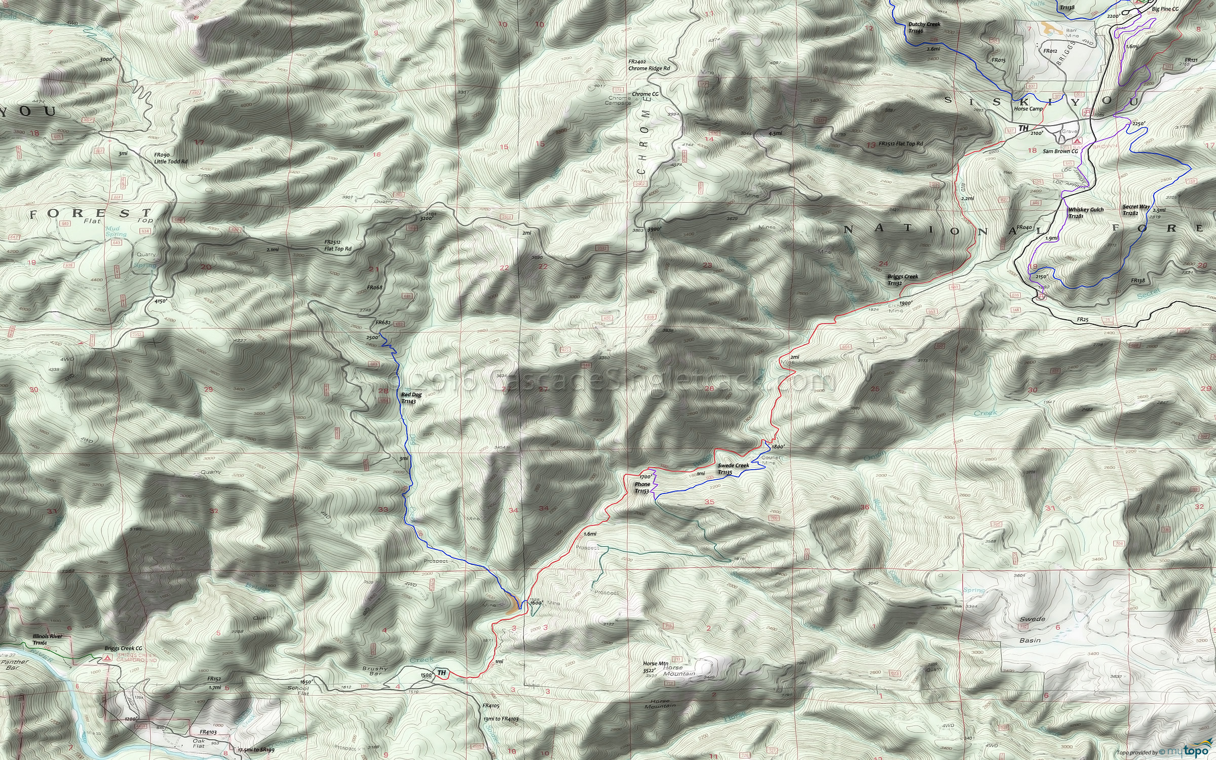
Briggs Creek Tr1132 Mountain Biking and Hiking Topo Map
Map includes: Briggs Creek, Phone, Red Dog, Swede Creek Mountain Bike and Hiking Trails.
TH: Ride from the Sam Brown CG on FR637, crossing the creek to begin the hillside traverse.
2.3mi: Briefly join FR040, then exiting the 4WD road at the corner, followed by a creek crossing to the east bank at 2.7mi.
4.2mi: Pass the Courier Mine Historic Cabin Site and Swede Creek Tr1135 intersection prior to crossing the creek to the west bank.
5.2mi: Cross the creek to the east bank, then pass the Phone Tr1153 intersection, followed by a Swede Creek crossing at 5.8mi.
6.7mi: Pass the Red Dog Tr1143 intersection, and several side paths to abandoned mine sites.
7.9mi: Reach the FR4105 TH, then return to the upper TH.
Draggable map: Map window adjusts to screen size and will respond to touch control. Use scrollbar for mouse control.
No Map? Browser settings and some browser extensions can prevent the maps from appearing. Please see Site Tech


