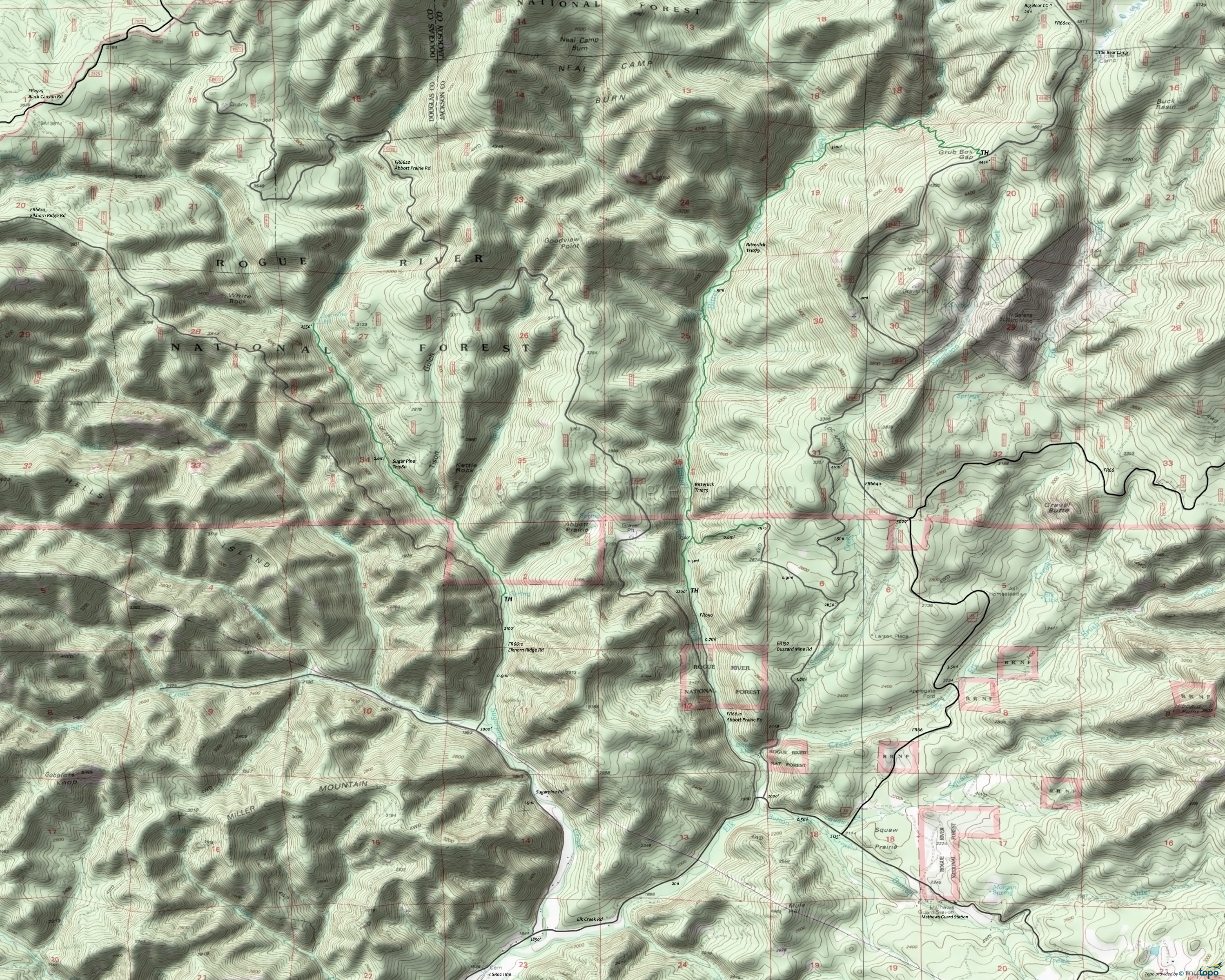
Bitterlick and Sugar Pine Hiking Topo Map
Map includes: Bitterlick Trail 1079, Sugar Pine Trail 1080 Hiking Trails.
Bitterlick Creek Tr1079 is primitive and not maintained, with seven creek crossings which are not possible/advisable during the Spring or after heavy rainfall. The southern TH is not suitable for cars.
The steepness of the trail makes riding south from Access 1 to Access 2 easier, as a shuttle or returning on the FR. Vegetation is lush along the creek. Old-growth Douglas-fir, sugar pine, and incense-cedar are found here along with dogwood, hazel, big-leaf maple, and vine maple.
Sugar Pine Trail 1080 follows Sugar Pine Creek for 3.1mi to Coalmine Creek, with many pools among the creek bedrock, providing cool refreshment for wading.
Due to low volume of use this trail receives limited maintenance. Expect to encounter downed logs and brush.
Be sure to check with the Prospect Ranger Station on the trail conditions of these abandoned and lightly used trails.
Mosquitoes are ferocious in this area until August. Feel free to try the natural repellents, and avoid drinking carbonated drinks prior to riding, but Deet 100 may be the only protection from 'the swarm'. Expect some trailside poison oak and prepare as needed. Try using Tecnu before the ride.
Draggable map: Map window adjusts to screen size and will respond to touch control. Use scrollbar for mouse control.
No Map? Browser settings and some browser extensions can prevent the maps from appearing. Please see Site Tech


