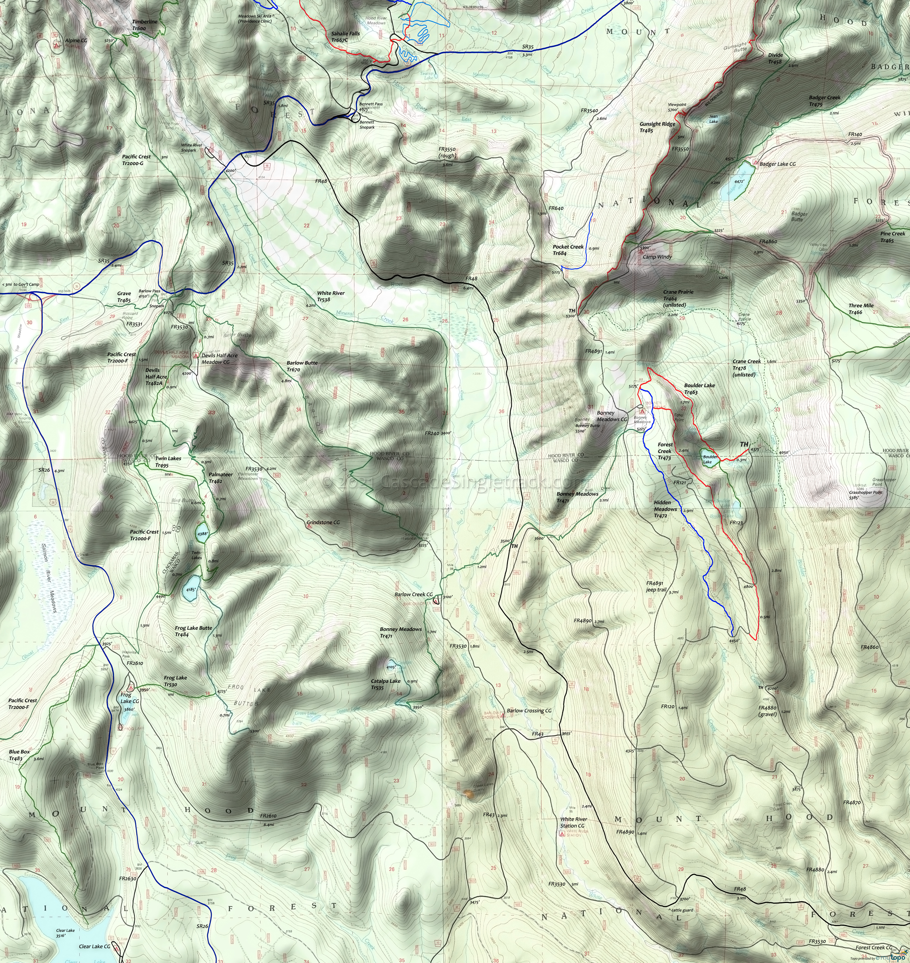
Boulder Lake Area Mountain Biking and Hiking Topo Map
Twitter Search
#OregonTimberTrail
Map includes: Badger Creek Trail 479, Barlow Butte Trail 670, Blue Box Trail 483, Bonney Meadows Trail 471, Boulder Lake Trail 463, Catalpa Lake Trail 535, Devils Half Acre Trail 482A, Forest Creek Trail 473, Frog Lake Trail 530, Frog Lake Butte Trail 484, Hidden Meadows Trail 472, Little Boulder Trail 463A, Pacific Crest Trail 2000-G, Palmateer Trail 482, Twin Lakes Trail 495, White River Trail 538 Mountain Biking and Hiking Trails.
Oregon Timber Trail: Bonney Meadows Trail 471 and Gunsight Ridge Tr485 are part of the Hood Tier route.
A moderate 11mi, (3800', 7% ascent) loop ride starts at the FR4880 Boulder Lake TH, ascending Boulder Lake Tr463 to Forest Creek Tr473, returning on Hidden Meadows Tr472, with a CW loop providing an easier ascent.
Intermediate loop: The 18mi, (3800', 7%) Boulder Lake Tr463 to Gunsight Tr485 OAB. FR3550 can be used as an alternative to returning on Gunsight Tr485.
Draggable map: Map window adjusts to screen size and will respond to touch control. Use scrollbar for mouse control.
No Map? Browser settings and some browser extensions can prevent the maps from appearing. Please see Site Tech


