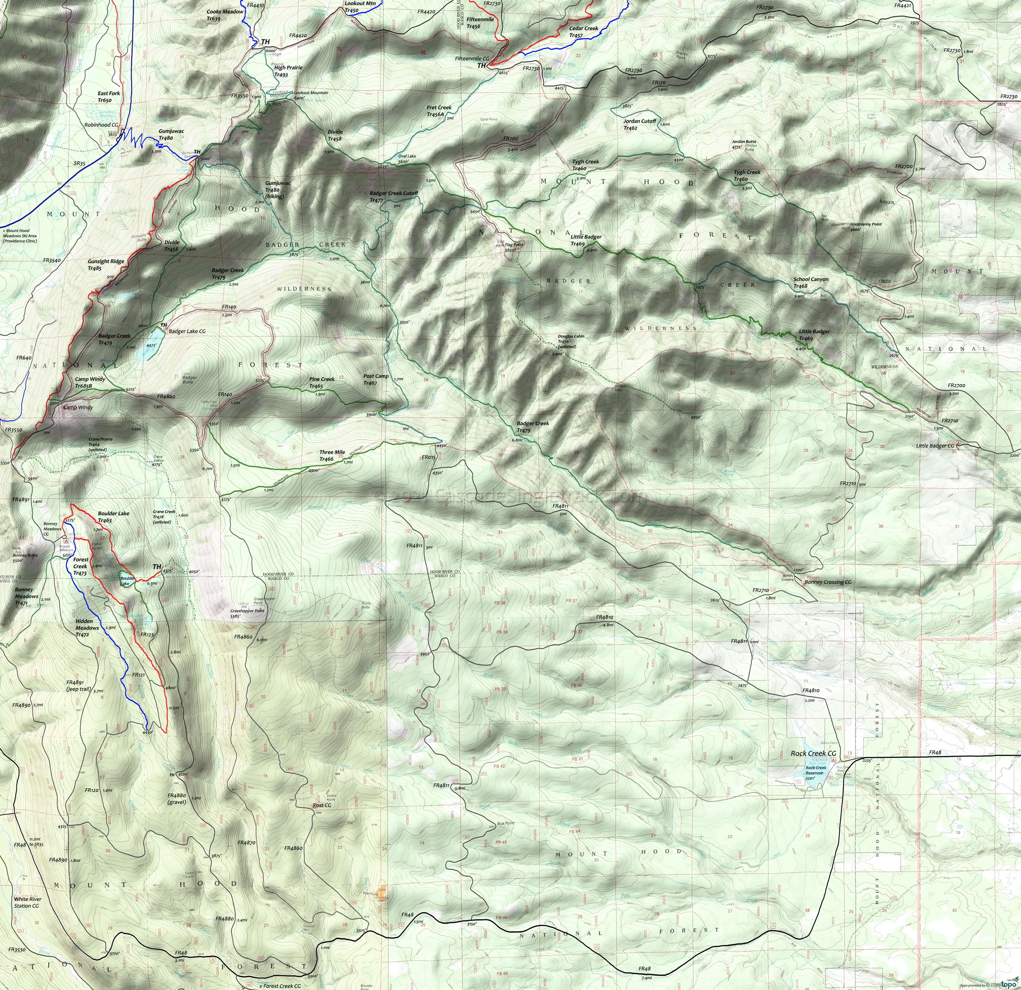
Badger Creek Wilderness Hiking Topo Map
Twitter Search
#BadgerCreekWilderness
Map includes: Badger Creek Trail 479, Divide Trail 458, Douglas Cabin Trail 470, Fret Creek Trail 456A, Little Badger Trail 469, Pine Creek Trail 465, Post Camp Trail 467, School Canyon Trail 468, Three-Mile Trail 466, Tygh Creek Trail 460
Easy access and well-suited for shuttle hiking makes the Badger Creek Wilderness Area a popular day and overnight hiking destination. Several well-located campgrounds to choose from, with just as many good hiking loops possible.
From Badger Lake, Divide Tr458 ascends to Lookout Mountain, then extends east to FR200 near Flag Point, and can be combined with Badger Creek Cutoff Tr477 for a challenging day hike. At 6525', Lookout Mountain is the second highest peak in the Mount Hood forest.
Post Camp Tr467, Pine Creek Tr465, Tygh Creek Tr460 and School Canyon Tr468 see little use and may not be maintained. Casey Creek Tr476 was washed out and won't be passable until rerouted.
Little Badger Tr469 ascends through a variety of forest types, including oak thickets and sub-alpine fir meadows, from Little Badger CG to Flag Point, with numerous campsites along Badger Creek.
With over a dozen campsites along the way, the very popular Badger Creek Tr479 ascends from the Bonney Crossing CG to Badger Lake and is well suited for a shuttle or combined with other trails for a hiking loop.
Draggable map: Map window adjusts to screen size and will respond to touch control. Use scrollbar for mouse control.
No Map? Browser settings and some browser extensions can prevent the maps from appearing. Please see Site Tech


