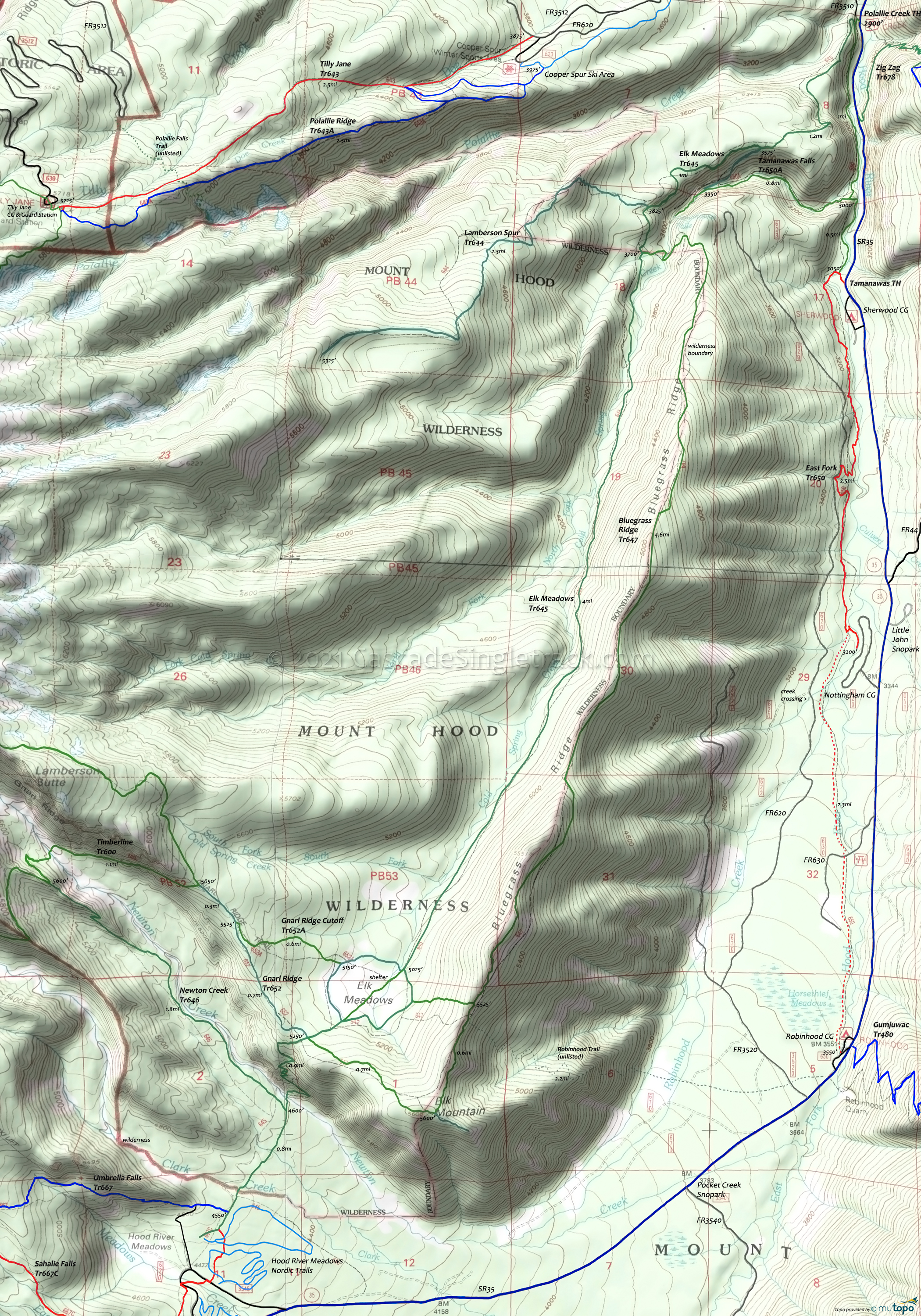
East Fork Area Mountain Biking and Hiking Topo Map
Map includes Bluegrass Ridge Trail 647, East Fork Trail 650, Elk Meadows Trail 645, Gnarl Ridge Trail 652, Lamberson Spur Trail 644, Newton Creek Trail 646, Robinhood Trail 11, Tamanawas Falls Trail 650B Mountain Biking and Hiking Trails.
East Fork OAB
TH: From the FR3510 TH, pass the Elk Meadows Tr645 intersection on the right, then traverse two steep hillside ascents.
1mi: Cross Cold Spring creek and pass the Tamanawas Falls Tr650B intersection on the right. Climb around the hillside, cross a creek at 1.6mi, then pass the Sherwood campground intersection at 1.9mi.
2.2mi: Go past several intersections with FR620 over the next .8mi.
4.8mi: Cross FR630 then ride alongside Horsethief Meadows to the Robinhood campground.
Draggable map: Map window adjusts to screen size and will respond to touch control. Use scrollbar for mouse control.
No Map? Browser settings and some browser extensions can prevent the maps from appearing. Please see Site Tech


