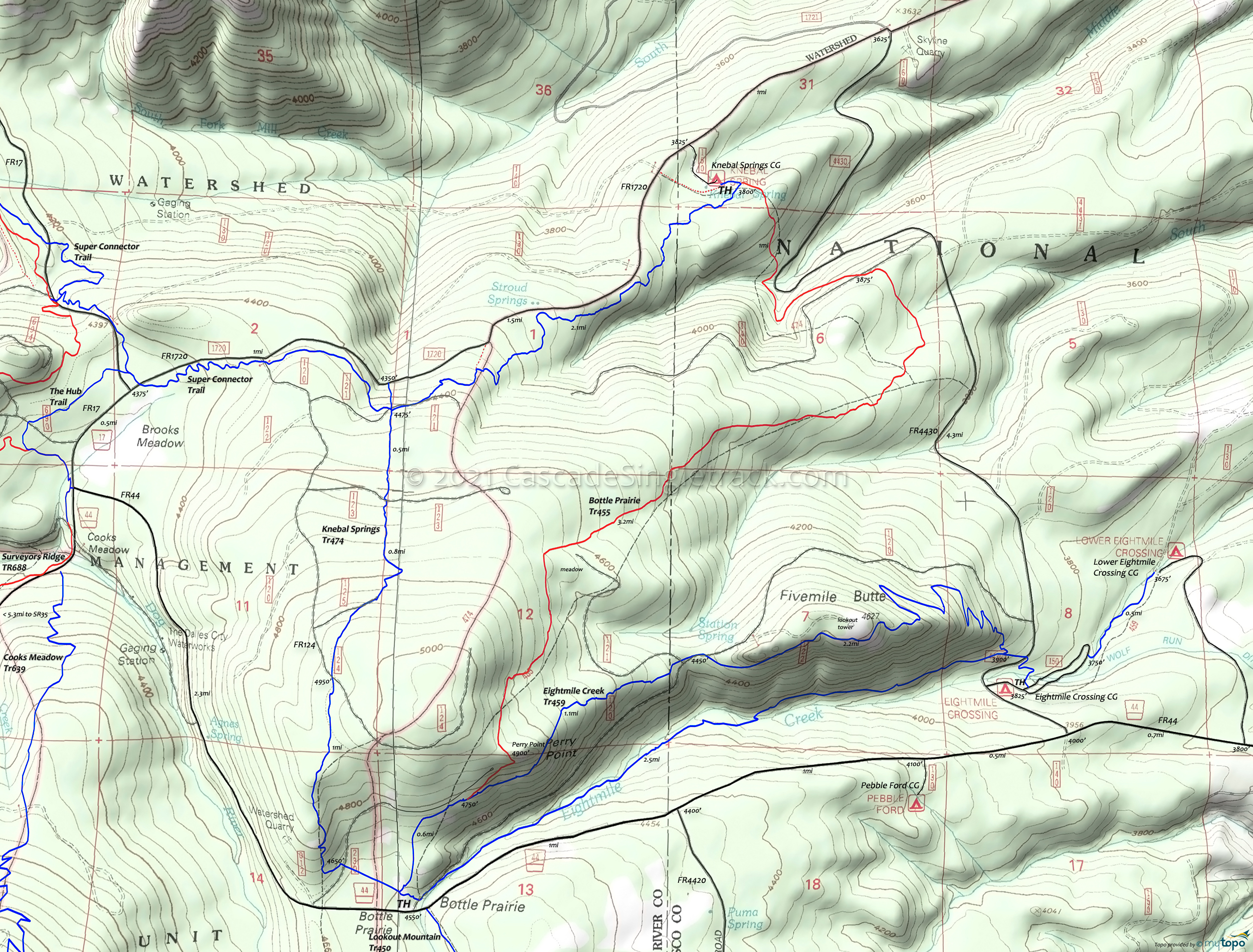
Eightmile Creek Trail Area Mountain Biking and Hiking Topo Map
Map includes Bottle Prairie Trail 455, Eightmile Creek Trail 459, Knebal Springs Trail 474 Mountain Biking and Hiking Trails.
Eightmile Creek CW Loop
TH: Start at the Eightmile Crossing Campground for the CW Loop. Cross FR4432 then go left onto Eightmile Creek Tr459.
2.7mi: After gradually climbing alongside Eightmile Creek, reach the Bottle Prairie Campground and go to the North end of the CG, then start the ascent. Go right at the Knebal Springs Tr474 intersection.
3.3mi: Bear right at the Bottle Prairie Tr455 fork, to stay on Eightmile Creek Tr459. Ascend to Perry Point.
4.4mi: After a fast descent from Perry Point, trail merges with FR120 for .1mi, with a short lookout tower OAB option.
5mi: Bear right then start the switchback descent.
6.7mi: Go left at the four way intersection, then cross FR4430 and go back to the TH.
Draggable map: Map window adjusts to screen size and will respond to touch control. Use scrollbar for mouse control.
No Map? Browser settings and some browser extensions can prevent the maps from appearing. Please see Site Tech


