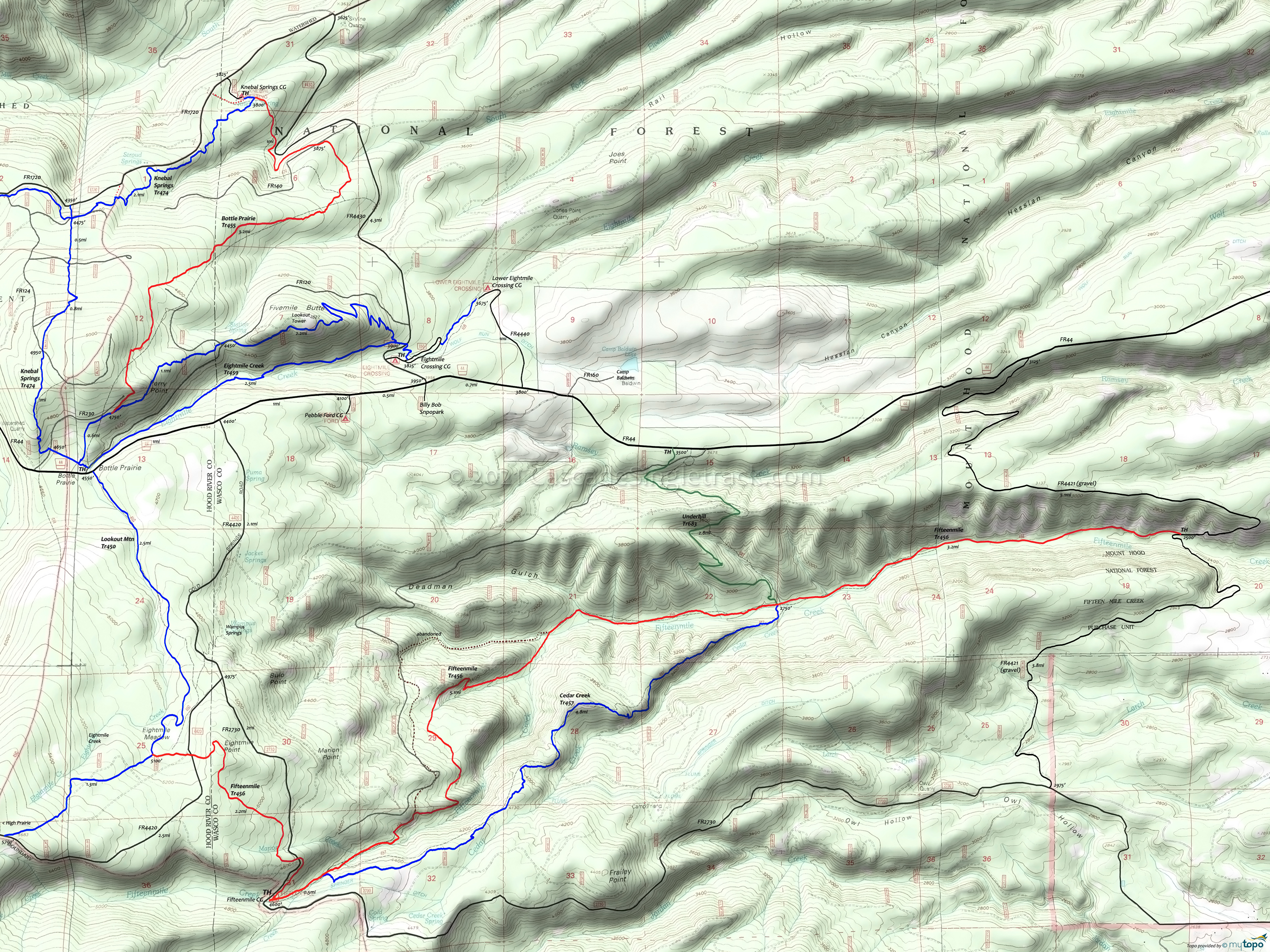
Fifteenmile and Cedar Creek Area Mountain Biking and Hiking Topo Map
Map includes: Bottle Prairie Trail 455, Cedar Creek Trail 457, Cooks Meadow Trail 639, Eightmile Creek Trail 459, Fifteenmile Trail 456, Knebal Springs Trail 474, Lookout Mountain Trail 450 and Underhill Trail 683 Mountain Biking and Hiking Trails.
The CW alternative results in a longer, more gradual downhill, about a mile of hike-a-bike up Cedar Creek, then a slightly easier climb back to the TH.
The alternative shown in the guide below starts from FR44, with Underhill Tr683 helping to eliminate the inverted ride profile, creating a 14mi (4100' climb) lollipop loop.
This does include a 1mi, 16% grade from the Underhill/Fifteenmile intersection.
Draggable map: Map window adjusts to screen size and will respond to touch control. Use scrollbar for mouse control.
No Map? Browser settings and some browser extensions can prevent the maps from appearing. Please see Site Tech


