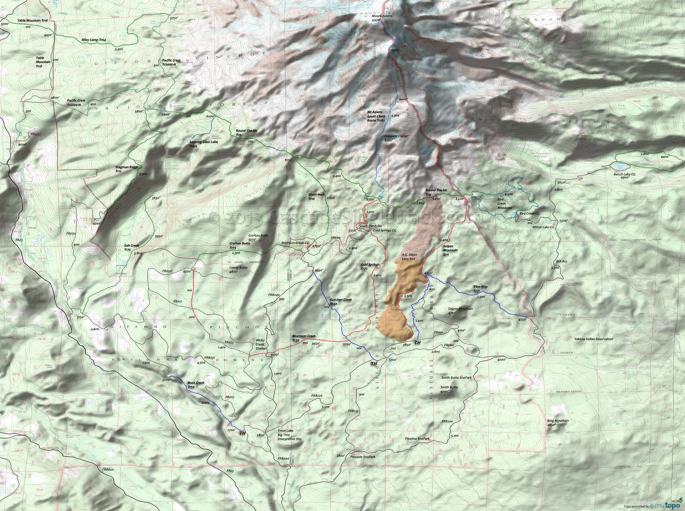
Morrison Creek: Round-The-Mtn Trail and Snipes Mountain Trail Area Mountain Biking and Hiking Topo Map
Twitter Search
#PacificCrestTrail
Map includes: Cold Springs Trail 72, Crofton Butte Trail 73, Gotchen Creek Trail 40, Mt Adams South Climb Route Trail 183, Pacific Crest Trail 2000-H, Pine-Way Trail 71, Round-The-Mtn Trail 9 and Snipes Mountain Trail 11 Mountain Biking and Hiking Trails.
TH: From the lower Gotchen Cr Tr40 TH, continue on FR8020 to FR150, then go left and go .7mi to Snipes Mt Tr11, then start climbing alongside the A.G. Aiken lava flow.
3.4mi: Pass the Pine-Way Tr71 intersection. The trail breaks away from the lava flow at 3.9mi, continuing to climb alongside the Gotchen Creek.
5.8mi: Go left on Round-The-Mt Tr9, at the edge of the wilderness area, reaching the ride summit at 6.4mi.
7.7mi: Go left on Mt Adams South Climb Route Tr183 and begin steep downhill to the South Climb TH.
9.1mi: Go through the Cold Springs campground and continue the descent, alongside the north side of the Aiken lava flow..
12.5mi: Reach Gotchen Cr Tr40 and go left to return to the TH.
Draggable map: Map window adjusts to screen size and will respond to touch control. Use scrollbar for mouse control.
No Map? Browser settings and some browser extensions can prevent the maps from appearing. Please see Site Tech


