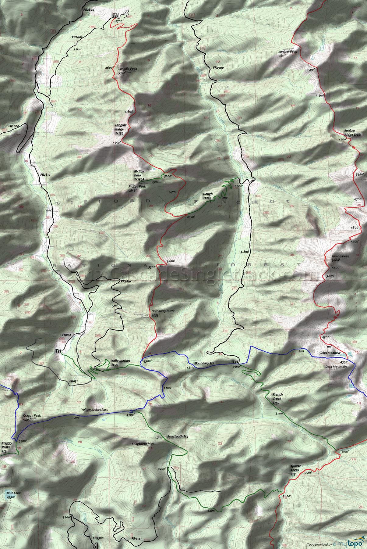
Boundary Trail 1 and Langille Ridge Trail 259 Area Mountain Biking and Hiking Topo Map
Map includes Boundary Trail 1, French Creek Trail 5C, Langille Ridge Trail 259, McCoy Peak Trail 259A, Rough Trail 283, Snagtooth Trail 4 and Yellowjacket Trail 1A Mountain Biking and Hiking Trails.
TH: Ride 1.6mi West on Boundary Tr1 to Langille Rdg Tr259, ascending 700' out of a drainage in the last .6mi to reach the ridgeline.
1.6mi: Go right onto Langille Rdg Tr259 and continue to climb to Holdaway Butte, descend, then climb 900' to the next ridge top. Descend 1000' through noble fir and hemlock forest to the Rough Tr283 intersection.
5mi: From the Rough Tr283 intersection, the trail drops into Bear Creek then starts the 1400' Langille Creek summit ascent. Pass the McCoy Peak Tr259A intersection at 6.7mi, then go by a small spring and pond at 6.9mi. #259A is a very primitive trail which may be hard to follow.
7.6mi: At the summit, above the Langille Creek headwater drainage. Descend to Langille Peak (9.3mi) then return to TH.
Draggable map: Map window adjusts to screen size and will respond to touch control. Use scrollbar for mouse control.
No Map? Browser settings and some browser extensions can prevent the maps from appearing. Please see Site Tech


