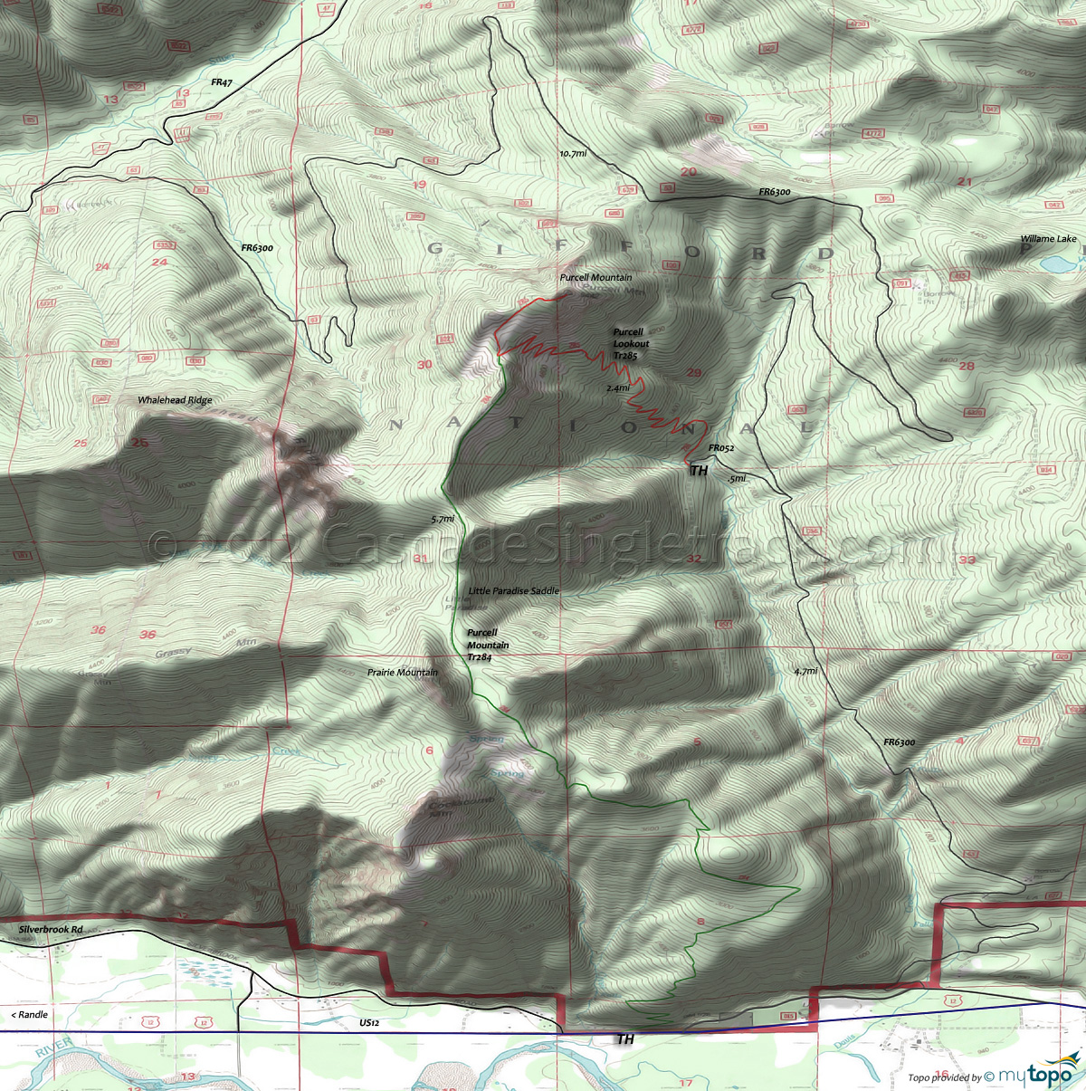
Purcell Lookout Trail 285, Purcell Mountain Trail 284 Mountain Biking and Hiking Topo Map
Purcell Mountain: Purcell Lookout Tr285 is open to biking but ascends 2650' in 2.9mi (17% ascent) at a steady pace through endless switchbacks, so is essentially unclimbable.
Hiking trail Purcell Mountain Tr284 is a ridgeline ascent, with a steady climb to Prairie Mountain, then a ridgeline hike past Little Paradise saddle to the Purcell Mountain summit.
Woods Creek Hiking: Woods Creek Watchable Wildlife Tr247 along with Old Growth Loop Tr247A offers a family-friendly hiking option, looping through five habitat areas, offering hikers an opportunity to learn about wildlife habitats needed by different species. The trail passes through a mixed hardwood conifer forest, breaks into an open meadow and circumnavigates a beaver pond. Environmental Education Lab Packs can be borrowed from the Randle Ranger Station.
Draggable map: Map window adjusts to screen size and will respond to touch control. Use scrollbar for mouse control.
No Map? Browser settings and some browser extensions can prevent the maps from appearing. Please see Site Tech


