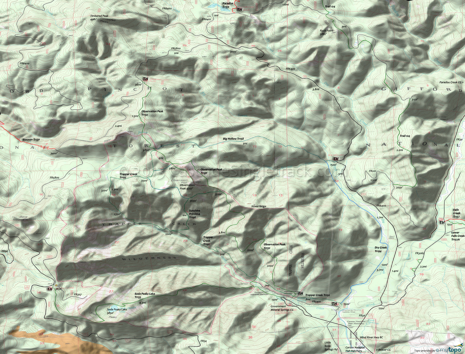
Trapper Creek Wilderness Hiking Topo Map
Map includes Big Hollow Trail 158, Observation Peak Trail 132, Soda Peaks Lake Trail 133, Sunshine Primitive Trail 198, Trail 124 and Trapper Creek Trail 192.
The 3mi Big Hollow Trail 158 upper TH is at the primitive Berry Camp (at the intersection with Observation Peak Tr132). Descending 400' over the first 1mi, the Hollow Creek fork crossing then must be forded with care (avoid after heavy rain or during Spring runoff). The Big Hollow Creek crossing is also challenging during Spring runoff.
Observation Peak Trail 132 ascends steadily (2600' in 5mi) along the ridge to the summit, through a second-growth Douglas fir forest, crossing terrain steep enough to remain snow-bound till late Spring.
The easily accessible Soda Peaks Lake Trail 133 traverses a saddle, then switchbacks through a conifer forest to the bowl shaped (glacial-carved cirque) Soda Peaks Lake.
Sunshine Primitive Trail 198 is a rarely used, steep and often treefall-strewn excursion, which may seem a shortcut but only if GPS-equipped. The trail surface is sometimes loose and sandy, and often hard to find.
Draggable map: Map window adjusts to screen size and will respond to touch control. Use scrollbar for mouse control.
No Map? Browser settings and some browser extensions can prevent the maps from appearing. Please see Site Tech


