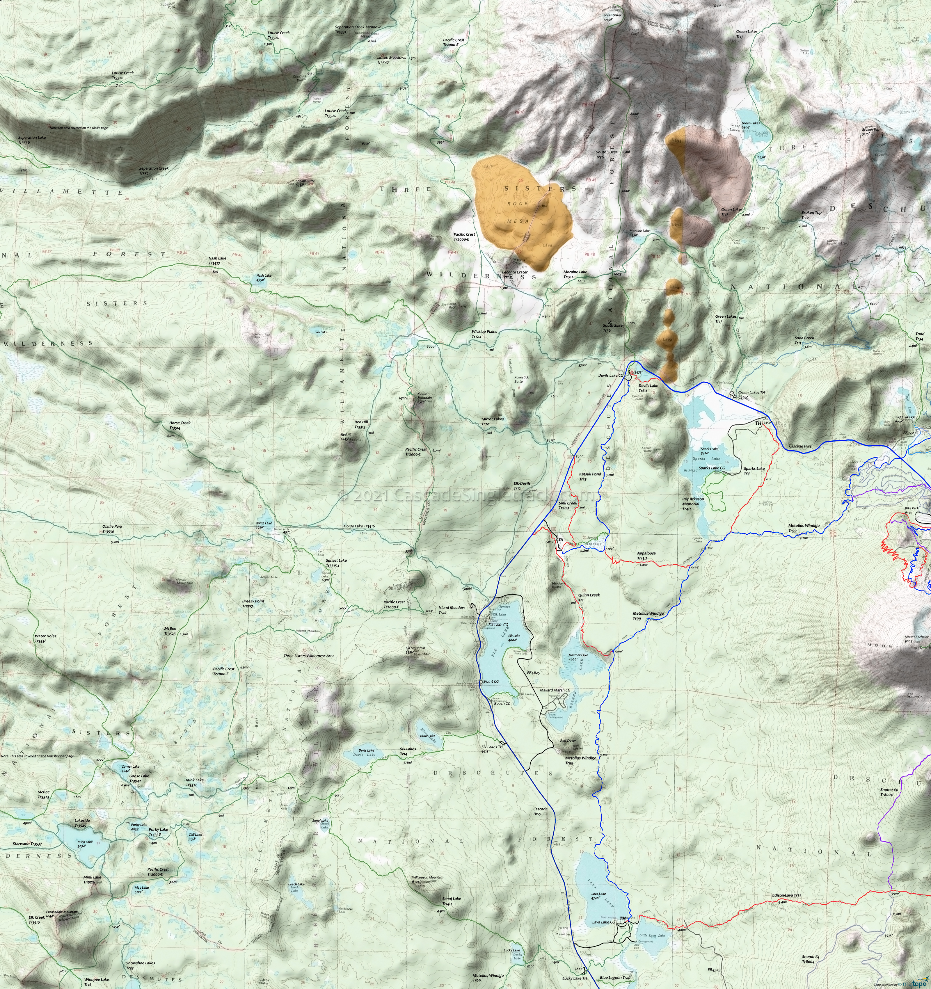
Sparks Lake Trail Area Mountain Biking and Hiking Topo Map
Twitter Search
#PacificCrestTrail
Map includes Appaloosa Trail 13.2, Devils Lake Trail 6.1, Katsuk Pond Trail 13, Metolius-Windigo Trail 99, Pacific Crest Trail 2000-E, Quinn Creek Trail 1, Sink Creek Trail 20.1, Sparks Lake Trail 4 Mountain Biking and Hiking Trails.
Starting in 2021, the Mt. Jefferson, Mt. Washington, and Three Sisters Wilderness Areas will require a Central Cascades Wilderness Permit for Day or Overnight use, from May 28th to Sept 24th.
TH: Descend alongside Quinn Creek to the top of Hosmer Lake, then ascend sharply to the top of the butte and ride over to Metolius-Windigo Tr99.
2.2mi: Go left on Metolius-Windigo Tr99, with .8mi of flat terrain followed by a 1.2mi, 330' climb to the Appaloosa Tr13.2 intersection, continuing over relatively flat terrain to Sparks Lake Tr4.
5.1mi: Go left at the fork onto Sparks Lake Tr4 and ascend uneven terrain to the ride summit at 6.4mi, then descend to the Sparks Lake road at 7.2mi, then return to the Quinn Creek TH.
Option: Return on Appaloosa Tr13.2 and Katsuk Pond Tr13.
Three Sisters Wilderness: Map covers the area over to the Willamette NF, including Elk-Devils Trail 12, Mink Lake Basin Trail 3525, Mirror Lakes Trail 20, Moraine Lake Trail 17.1, Nash Lake Trail 3527, Olallie Park Trail 3530, Pacific Crest Trail 2000-E, Red Hill Trail 3315, Senoj Lake Trail 14.1, Six Lakes Trail 14, South Sister Trail 36, Wickiup Plains Trail 12.1
Draggable map: Map window adjusts to screen size and will respond to touch control. Use scrollbar for mouse control.
No Map? Browser settings and some browser extensions can prevent the maps from appearing. Please see Site Tech


