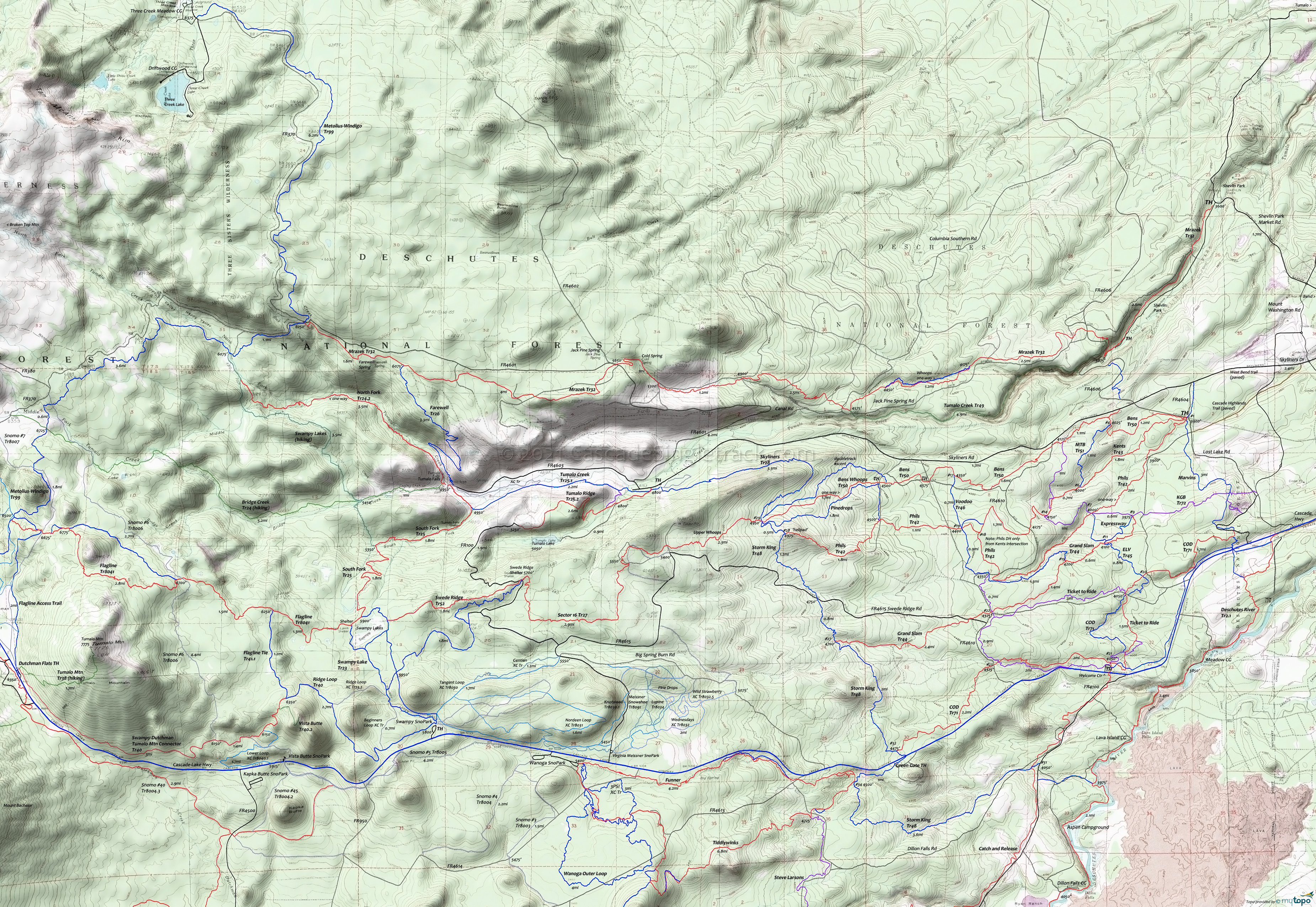
Mrazek Trail Area Mountain Biking and Hiking Topo Map
Twitter Search
#MrazekTrail
#BendTrails
Map includes Bens Trail 50, Farewell Trail 26, Mrazek Trail 32, North Fork Trail 24.2, Skyliners Trail 28, Tumalo Creek Trail 49 Mountain Biking and Hiking Trails.
TH: Mrazek Tr32 starts from the north side of the gravel parking lot, just inside the gate. Attempt to stay on the hillside, above the road, although there are a number of access trails between Mrazek Tr32 and Saddleback Dr. Cross Jack Pine Spring Rd at .7mi. This road becomes Tumalo Creek Rd and parallels Mrazek Tr32 for the first 10.5mi, with several crossings along the way.
2.5mi: Go sharply to the right at the fork, and ascend the .4mi switchback section as Mrazek Tr32 exits the Tumalo Creek drainage. Cross FR4606 at 3.2mi, then other doubletrack at 3.4mi and 5.3mi, with gradual ascent over twisty singletrack.
7.5mi: After riding on the bank of the Southern Canal, reach the intersection with Tumalo Creek 2 Tr49 (hiker only). Go right to cross the canal, then cross the Columbia Southern Rd and another doubletrack at 7.8mi, as the climb gets a little more intense. Cross Jack Pine Spring Rd at 9.3mi and ascend to Cold Spring, the steepest section of the ride.
10.6mi: The trail merges with Jack Pine Spring Rd then breaks off to the left again. If lost, then take one of the doubletracks to FR4601 and ride north, or make this the turnaround point.
11.1mi: Cross FR4601, as the ascent moderates. Cross doubletrack at 11.5mi, 12.4mi and 12.6mi, covering moderate terrain.
14.2mi: Pass the Farewell Tr26 intersection on the left, then ascend to Metolius-Windigo Tr99, the ride summit and turnaround point for this OAB ride.
Draggable map: Map window adjusts to screen size and will respond to touch control. Use scrollbar for mouse control.
No Map? Browser settings and some browser extensions can prevent the maps from appearing. Please see Site Tech


