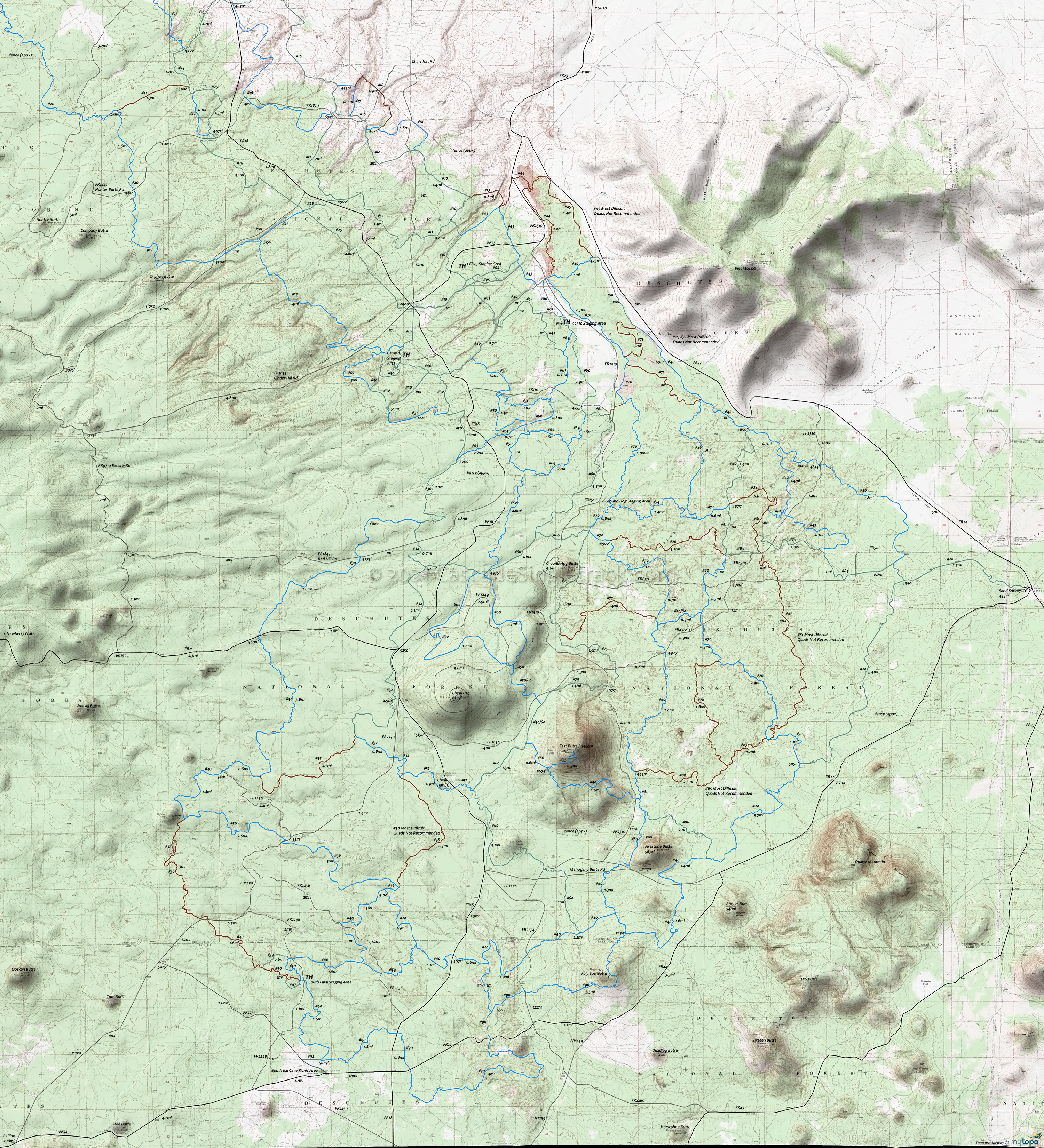
East Fort Rock OHV Trail Map
Twitter Search
#EastFortRockOHV
The Map shows the following levels of difficulty: Brown = High, Blue = Moderate, Green = Easiest. Several trails are not recommended for Quads, noted with comments.
Trail locations and distances are approximate, subject to change due to weather and use. The area is well signed, and please respect any posted trail restrictions.
See the Deschutes NF OHV page for the OHV staging area and Class restrictions info.
There are four staging areas, a campground/staging area, and four well-marked areas over 83mi of trails.
The trail system is designed for Class I (Quads, 3-wheelers less than 50" wide and 800 pounds) and Class III (motorcycles) ATVs.
Class II vehicles (side by sides, jeeps, etc) are allowed on routes designated as shared use only.
All trails are open to horses, mountain bikes, and others, so please watch for others and share the trails.
Staging areas: Road 2510 Staging Area, FR25 Staging Area, Camp 2 Staging Area, China Hat Campground, Ground Hog Rock Crawl and OHV Play Area, South Lava Staging Area. Staging areas have primitive facilities.
Draggable map: Map window adjusts to screen size and will respond to touch control. Use scrollbar for mouse control.
No Map? Browser settings and some browser extensions can prevent the maps from appearing. Please see Site Tech


