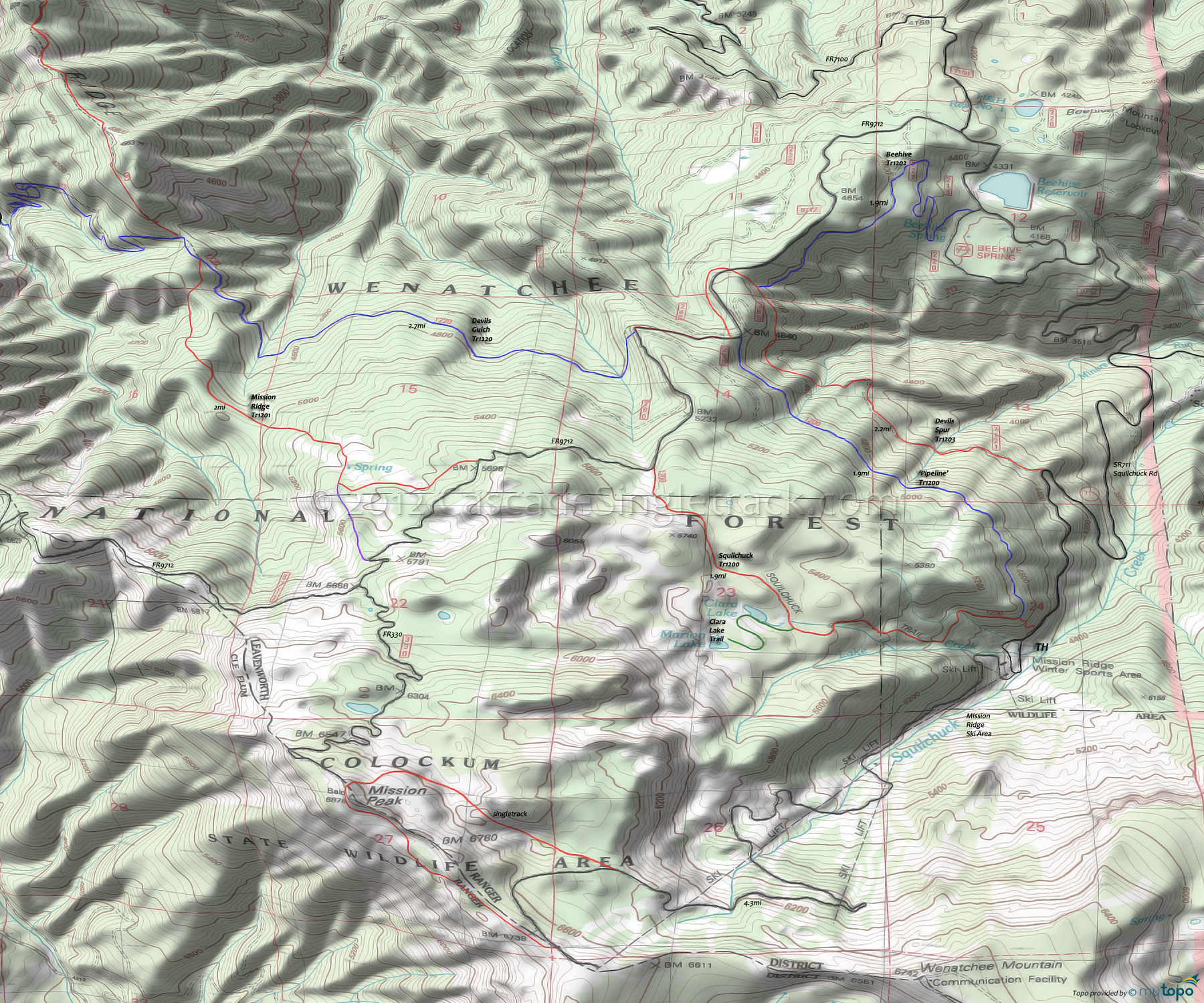
Clara Lake Trail and Squilchuck Trail 1200 Area Mountain Biking and Hiking Topo Map
Map includes: Beehive Trail 1202, Clara Lake Trail, Devils Gulch Trail 1220, Devils Spur Trail 1203, Mission Ridge Trail 1201, Mission Peak Trail and Squilchuck Trail 1200 Mountain Biking and Hiking Trails.
TH: Ride from the Mission Ridge Ski Area on SR711 to the Squilchuck Tr1200 TH, hike-a-bike to the T intersection and go left. After a steep climb, the terrain moderates, then pass the Clara Lake Trail intersection at 1mi. The terrain in this section is somewhat rocky and technical.
2mi: After a brief descent, go left on FR9712 and climb to the Mission Ridge Tr1201 TH.
2.7mi: At the sharp FR9712 curve (the ride summit), go right onto Mission Ridge Tr1201 and begin the fast descent to the Devils Gulch Tr1220 intersection. Pass a connector trail on the left at 3.2mi.
4.7mi: Pass through a minor saddle, then go right at the Devils Gulch Tr1220 fork intersection. Option: extend the ride with some Mission Ridge Tr1201 OAB.
7mi: After crossing East Fork Mission Creek tributaries at 5.3mi and 6.8mi, climb to FR9712 and go left .4mi to the northern Squilchuck Tr1200 TH and go right. Note: Not shown on the map but some riders use FR240 to parallel FR9712, then cross the road to Squilchuck Tr1200.
7.4mi: Go onto Squilchuck Tr1200, traverse the hillside over moderate terrain, and return to the TH.
Draggable map: Map window adjusts to screen size and will respond to touch control. Use scrollbar for mouse control.
No Map? Browser settings and some browser extensions can prevent the maps from appearing. Please see Site Tech


