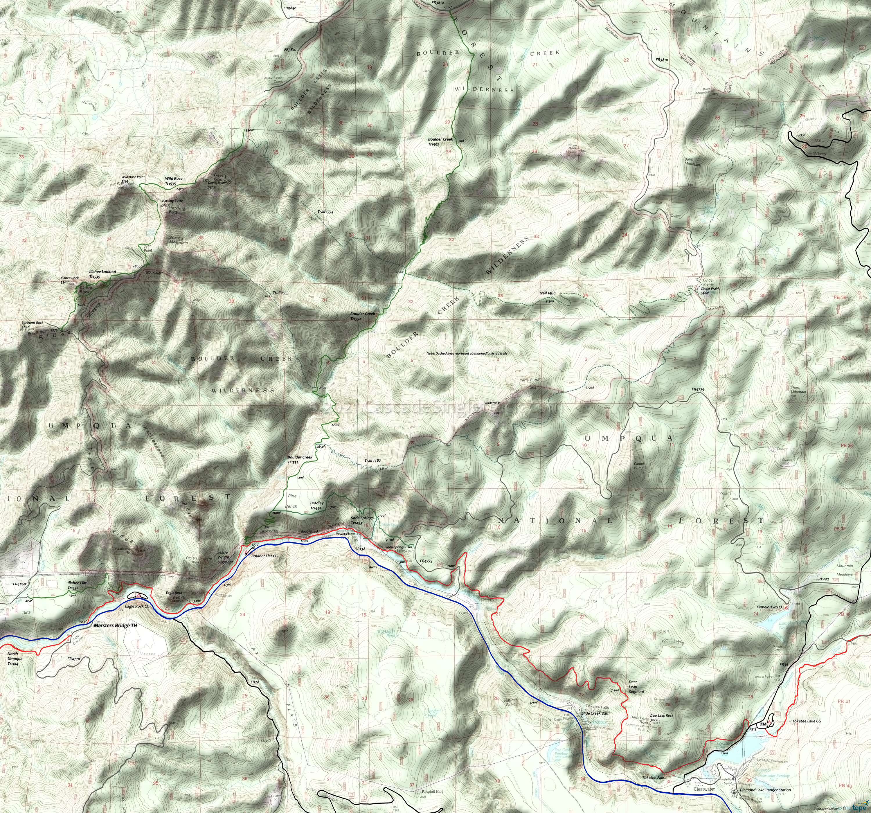
North Umpqua Trail 1414: Marsters to Toketee Area Topo Map
Map Includes: Boulder Creek Trail 1552, Bradley Trail 1491, North Umpqua River Trail 1414: Marsters to Toketee section, Illahee Flat Trail 1532, Soda Springs Trail 1493, Trail 1487.
The 1996 Spring fire affected the southern half of the Boulder Creek Wilderness. The unlisted trails in this area are shown with dashes. Check with the local ranger station prior to attempting any use of this terrain.
TH: From the Marsters bridge, ascend to the Dark Canyon creek crossing, then pass Illahee Flat Tr1532 on the left at .8mi. Descend to the riverside, then ride around the volcanic Eagle Rock formation, crossing Eagle Creek at 2.3mi. Cross Boulder Creek at 3mi, across the river from the Boulder Flat campground. The trail merges into FR101, which continues to the Soda Spring power plant.
4.4mi: Reach the Soda Spring power plant and reservoir. Ride under the penstock, bear left onto the singletrack, then ride around the reservoir. Ascend past FR4775 and cross Medicine Creek at 6.3mi, with terrain getting progressively steeper as the ride approaches the Deer Leap section.
7.3mi: Cross Slide Creek then ascend steeply for 1.3mi, while traversing the hillside. The trail levels off at 8.6mi, but continues to involve intense climbs even while descending towards Deer Leap Rock. Reach Deer Rock point at 11.1mi, followed by some cliff exposure and blind corners.
13.3mi: After crossing FR016 at 12.4mi and FR020 at 12.9mi, reach FR34, with an option to continue on the Dread and Terror section, go see Toketee Falls, or just ride back to the TH.
Draggable map: Map window adjusts to screen size and will respond to touch control. Use scrollbar for mouse control.
No Map? Browser settings and some browser extensions can prevent the maps from appearing. Please see Site Tech


