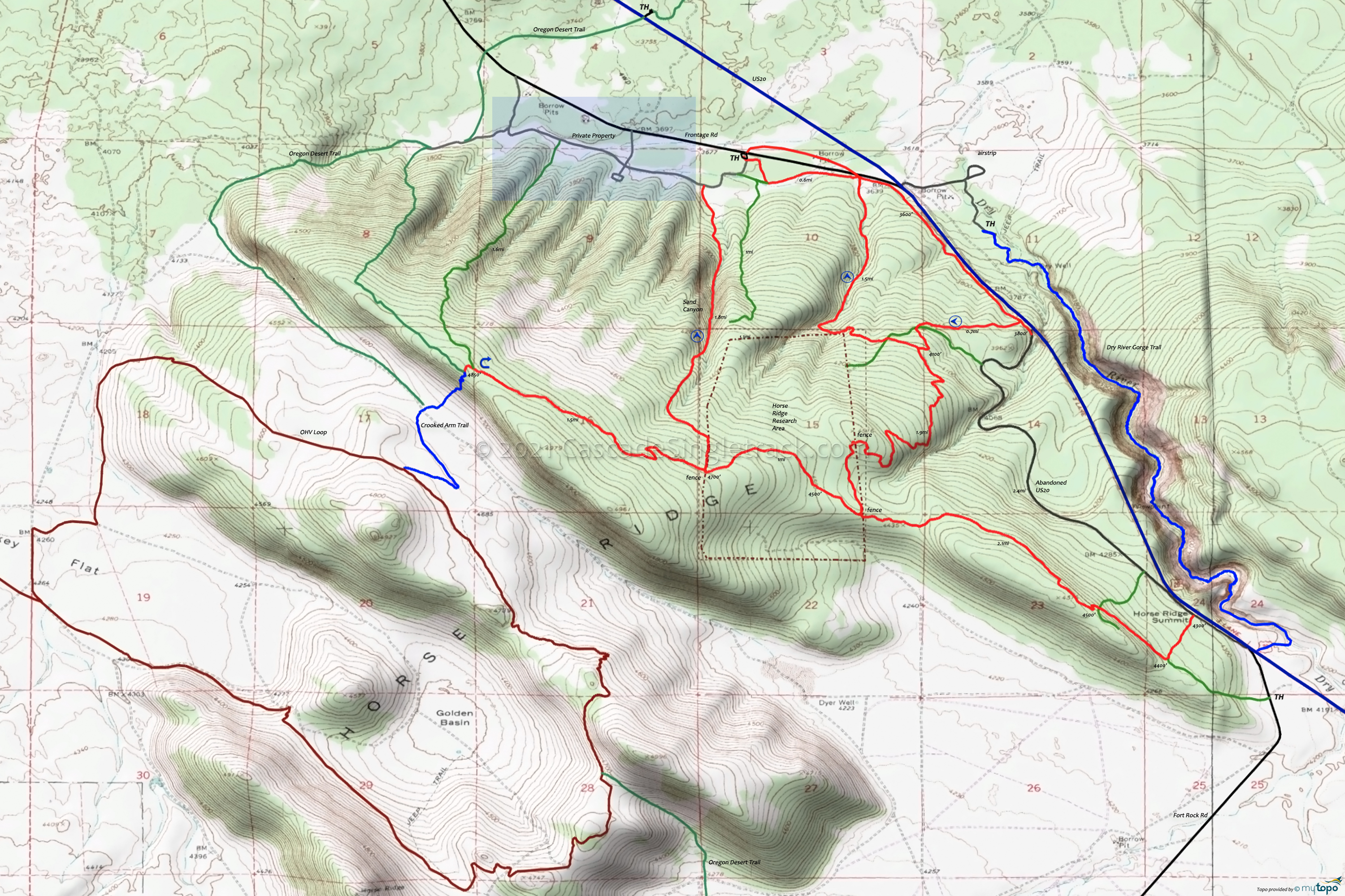
Horse Ridge Trails Mountain Biking and Hiking Topo Map
TH: Go left at the sign, just off the parking area. Ride along the frontage road, passing the return intersection at .6mi.
1.9mi: After ascending slowly along US20, pass the other return intersection at 1.8mi then go right onto the abandoned highway and enjoy the moderate ascent to Horse Ridge Summit.
4.3mi: Pass a jeep trail at 4mi then go right onto Horse Ridge Trail at 4.3mi. Bear right at the 4.6mi intersection with an abandoned jeep trail. Crest a 5.2mi knoll then descend to the 6.4mi fence. Cross the fence and continue on the trail, which continues to be mildly technical. Manage the speed and pick lines carefully.
7.3mi: Cross the western research area fence and pass the Sand Canyon intersection on the moderate viewpoint ascent.
8.9mi: Enjoy the open view of Newberry, Mt Bachelor and the Three Sisters, then enjoy the fast descent to the first and second fence.
11.3mi: Go left just prior to the eastern fence, immediately scale a little technical knoll, then begin the increasingly fast, winding downhill to the frontage road trail and back to the TH.
Watch for ascending bikers, as this route is often ridden in both directions.
Draggable map: Map window adjusts to screen size and will respond to touch control. Use scrollbar for mouse control.
No Map? Browser settings and some browser extensions can prevent the maps from appearing. Please see Site Tech


