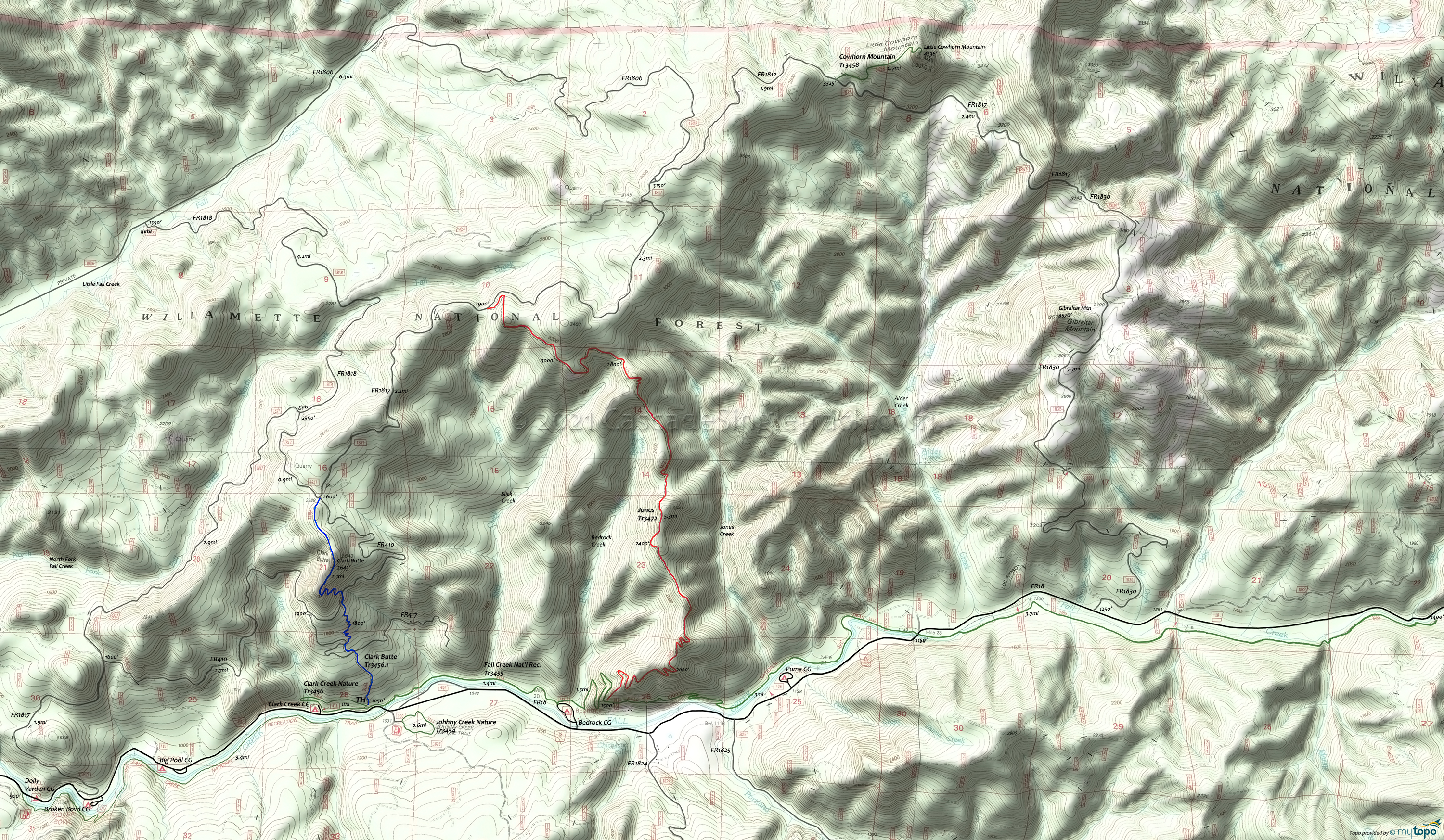
Clark Butte, Jones Area Mountain Biking and Hiking Topo Map
Map includes: Clark Butte Trail 3456.1, Clark Creek Nature Trail 3456, Fall Creek National Recreation Trail 3455, Johhny Creek Nature Trail 3454, Jones Trail 3472 Mountain Biking and Hiking Trails.
The 2020 Jones Creek fire has this terrain closed for now. The Fall Creek trail is also closed due to 2019 storm damage. See the NF Site for updates.
TH: Steep 1.5mi Clark Butte Tr3456.1 climb.
2.5mi: Go right on FR1817.
4.8mi: Go right on Jones Tr3472 with 4mi of undulating terrain, traversing the headwaters of Bedrock Creek and Slick Creek, followed by 2mi of steady descent.
10.1mi: At Fall Creek National Recreation Tr3455, either bail out to FR18 at Bedrock Campground, or walk the bike on the trail. Observe signs at the Clark Creek Nature Tr3456 as well, as the forest service may prohibit riding.
Draggable map: Map window adjusts to screen size and will respond to touch control. Use scrollbar for mouse control.
No Map? Browser settings and some browser extensions can prevent the maps from appearing. Please see Site Tech


