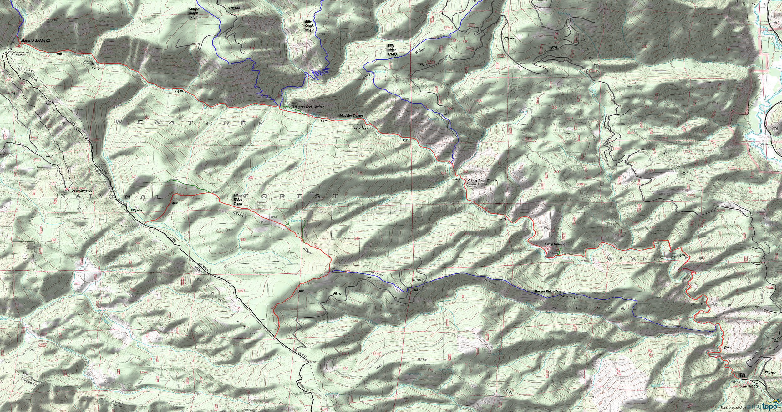
Hornet Ridge Trail 1410, Mad River Orv Trail 1409, Miners Ridge Trail 1411 Mountain Biking and Hiking Topo Map
TH: Begin the ascent from the Pine Flats campground, passing the Hornet Ridge Orv Tr1410 intersection/river crossing on the left at 1.5mi.
3mi: Just past a creek crossing, hike-a-bike .5mi up a steep, rocky slope, then descend back to the riverside at 4.4mi and cross Windy Creek at 4.8mi.
6mi: Cross a small creek then pass a sharp fork, leading to the Camp Nine campground. Cross a creek at 7.2mi then pass the Young Creek Shelter at 8.1mi.
8.5mi: Just past the Young Creek crossing, pass the Billy Ridge Tr1413 intersection on the right, at 8.6mi.
9.8mi: Use the footbridge to cross to the south side of Mad River, then cross Alma Creek at 10.5mi. A side trail to the Cougar Creek shelter intersects with the trail at 10.6mi.
11mi: Cross to the north side of Mad River, near the Cougar Creek shelter, at the intersection with Cougar Ridge Orv Tr1418. Cross a small creek at 12.2mi, then cross Berg Creek at 13.5mi, near the Berg Camp.
14.3mi: Reach the Maverick Saddle campground. Either head back or extend the ride with some of the other loops mentioned.
Draggable map: Map window adjusts to screen size and will respond to touch control. Use scrollbar for mouse control.
No Map? Browser settings and some browser extensions can prevent the maps from appearing. Please see Site Tech


