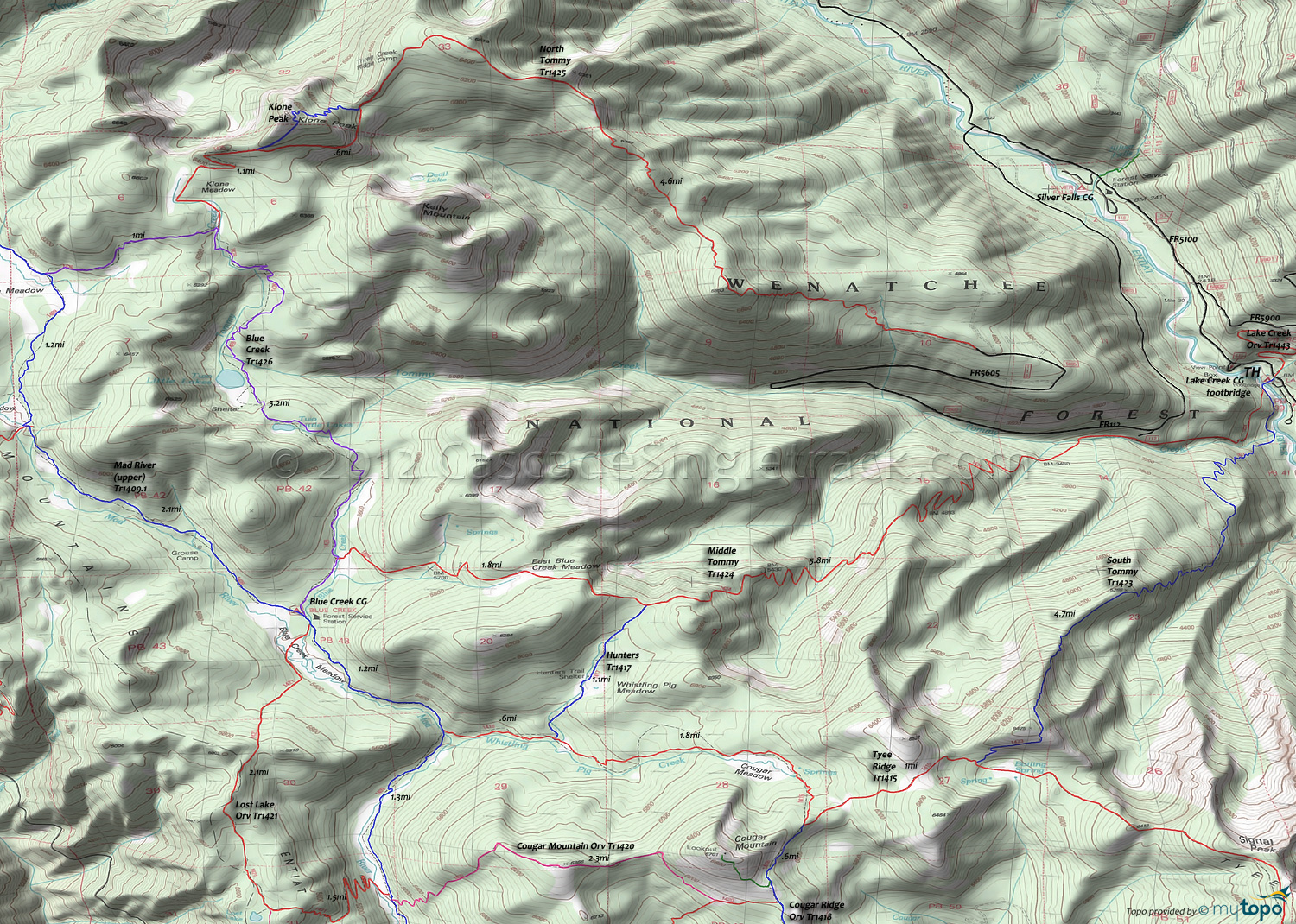
Middle Tommy Trail 1424, North Tommy Trail 1425 and South Tommy Trail 1423 Area Mountain Biking and Hiking Topo Map
Map includes: Blue Creek Trail 1426, Hunters Trail 1417, Mad River Trail 1409.1, Middle Tommy Trail 1424, North Tommy Trail 1425, South Tommy Trail 1423 and Tyee Ridge Trail 1415 Mountain Biking and Hiking Trails.
TH: From the FR112 TH, deal with the grinding FR5605 ascent, which turns to gravel .5mi before reaching North Tommy Orv Tr1425. Although there is parking at the North Tommy Orv Tr1425 TH, better to get the 4mi climb over with at the beginning, unless fortunate enough to have a shuttle partner. The Lake Creek campground is a good place for the other vehicle.
4mi: Ride out the west side of the trailhead parking area, on a doubletrack trail which turns to singletrack within .5mi, snaking towards the sky through an endless series of switchbacks. Complete this steepest section at 5.7mi, reaching the first of several peaks that form a kind of ridgeline, with four moderate descents and ascents to reach the Klone Peak summit.
7.3mi: With the steepest climb completed, the ascent moderates as it crosses a ridge, with the final Klone Peak summit ascent still to come. Pass the Three Creek Ridge Camp on the right at 8.3mi. Pass the Klone Peak summit trail on the right at 8.7mi.
9.4mi: After some serious cliff exposure near the Klone Peak summit, reach the highest elevation of the ride and pass the summit trail on the right. Go through two sharp switchbacks then ride around Klone Meadow.
10.5mi: Go left onto Blue Creek Orv Tr1426 and switchback past Two Little Lakes (there are two of them). Pass Lake Louise at 11.8mi, through a technical section which leads to Lake Ann, then descend alongside Blue Creek. Reach the Middle Tommy Orv Tr1424 intersection at 13.3mi. Riding Middle Tommy Orv Tr1424 back to the TH would shorten the ride by 1mi, but that's not a very epic thing to do. Go right to continue on Blue Creek Orv Tr1426, to Mad River Orv Tr1409.1.
13.8mi: Go left onto Mad River Orv Tr1409.1, near the forest service station. Go past Blue Creek Meadow then go left onto Tyee Ridge Orv Tr1415 at 15mi, then ride to the Hunters Orv Tr1417 intersection.
15.5mi: After climbing alongside Whistling Pig Creek, go left onto Hunters Orv Tr1417, and climb .5mi to Whistling Pig Meadow, passing the Hunters Trail shelter.
16.7mi: Go right onto Middle Tommy Orv Tr1424 and begin the steep descent to Tommy Creek, cross a steep drainage at 18.1mi, cross another creek at 20.7mi, then cross Tommy Creek at 20.1mi and return to the FR112 TH at 21.3mi.
Draggable map: Map window adjusts to screen size and will respond to touch control. Use scrollbar for mouse control.
No Map? Browser settings and some browser extensions can prevent the maps from appearing. Please see Site Tech


