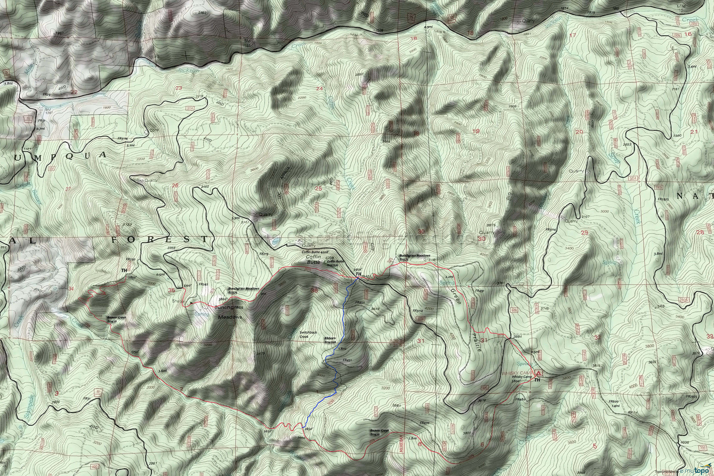
Beaver Creek Trail 1426 Mountain Biking and Hiking Topo Map
Map includes: Mountain Biking and Hiking Trails.
TH: From the Whisky Camp Guard Station TH, descend Beaver Creek Tr1426, crossing Maverick Creek and then FR480 at 0.2mi. and FR473 at 1.1mi. Pass the Elkhorn Tr1426A intersection on the right at 2.8mi. Descend through a series of steep switchbacks to Switchback creek at 3.2mi, followed by a Beaver Creek traverse to 4.8mi.
4.8mi: Ascend from the creek bed through the steepest section of the ride, in parallel with FR250 to the TH at 6.4mi. Go from FR250, right onto FR3114 and continue 0.4mi to the Bunchgrass Meadows Tr1575 TH..
7.2mi: Ascend the hillside, crossing FR242 at 7.4mi., to the Bunchgrass Meadows ridgeline, passing FR219 intersection at 8.3mi. and the Coffin Butte Tr1575A intersection.
9mi: Cross FR3114 and ascend to the ride summit at 9.6mi. Descend through Green Prairie, crossing FR491 at 10.5mi. Cross FR3114 at 10.9mi and descend to the Whisky Camp TH.
Draggable map: Map window adjusts to screen size and will respond to touch control. Use scrollbar for mouse control.
No Map? Browser settings and some browser extensions can prevent the maps from appearing. Please see Site Tech


