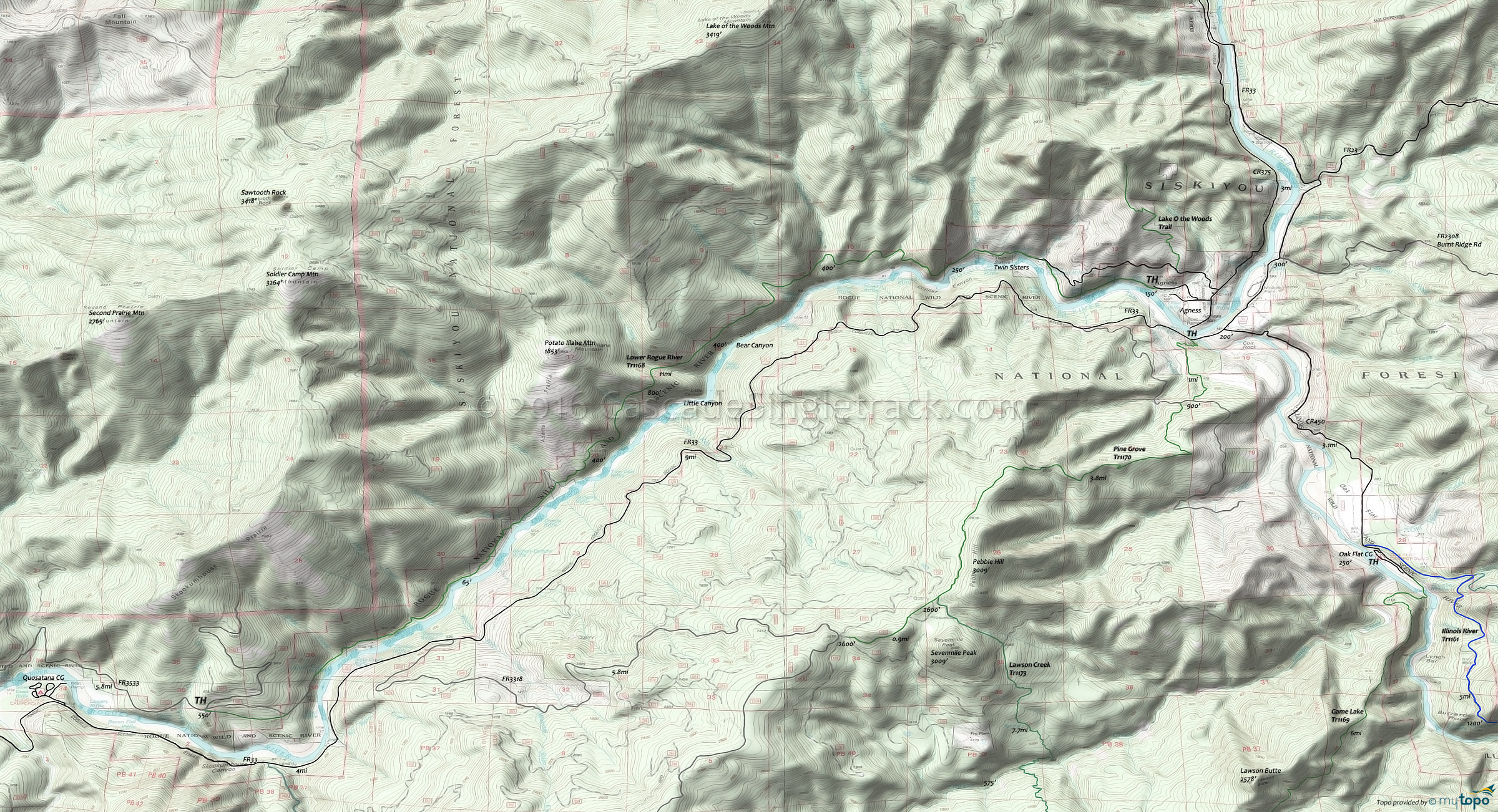
Lower Rogue River Tr1168 Hiking Topo Map
Map includes: Lower Rogue River, Lake O the Woods, Lawson Creek, Pine Grove Hiking Trails.
Moderate-grade hike through classic Northwest rain forest, including some 500 year old Douglas Fir.
The trail crosses a series of creeks, including a scenic waterfall at Auberry Creek.
There are some narrow sections of trail along steep cliffs
East TH: From Gold Beach, Oregon, take Jerry’s Flat Road (CR595, which becomes FR33) to Agness. Turn west on the CR375 (Old Agness Road), past the old Agness Post Office, to the Community Building TH.
Draggable map: Map window adjusts to screen size and will respond to touch control. Use scrollbar for mouse control.
No Map? Browser settings and some browser extensions can prevent the maps from appearing. Please see Site Tech


