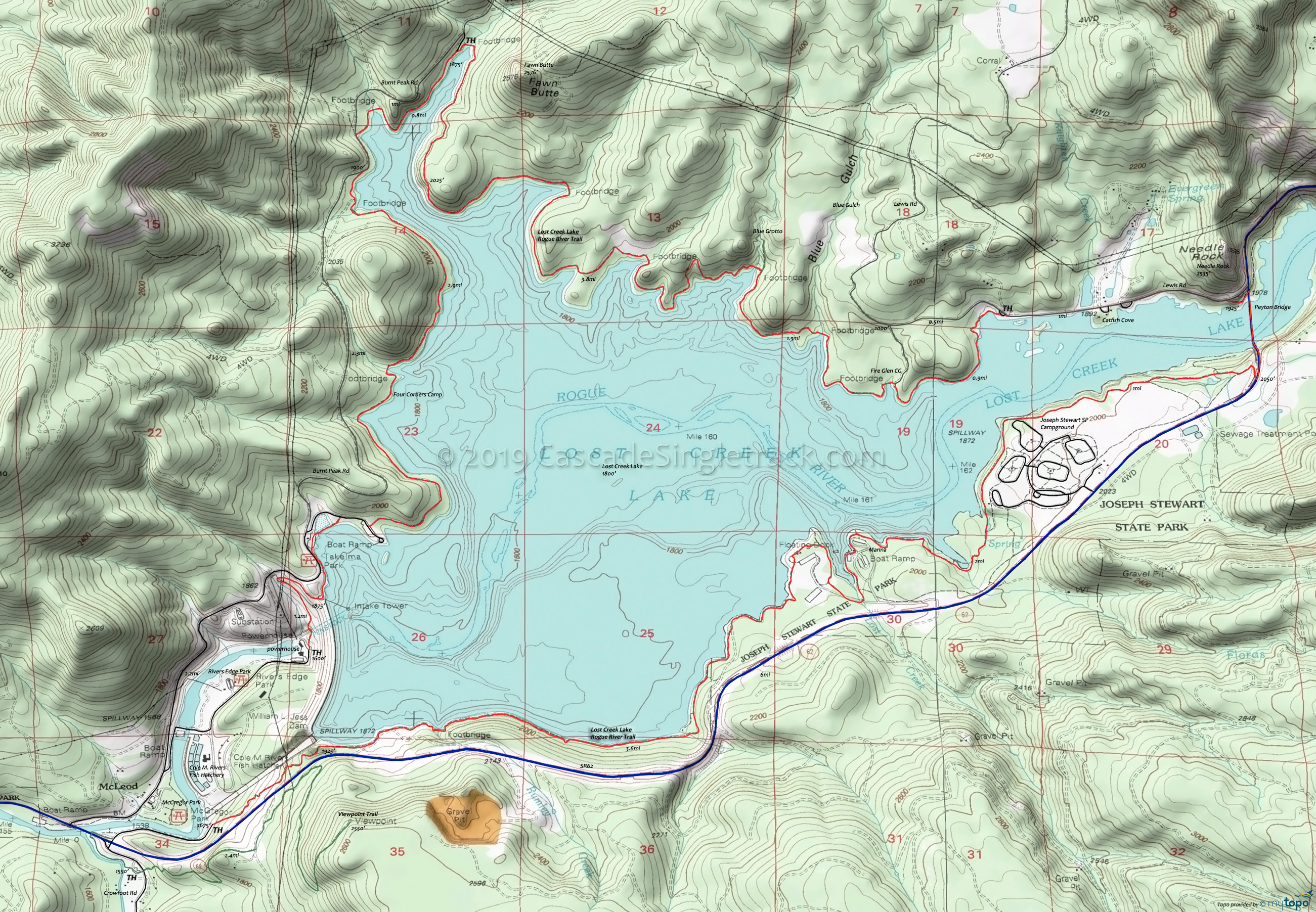
Lost Creek Lake Mountain Biking and Hiking Topo Map
Map includes: Lost Creek Lake Shoreline Trail, Blue Grotto Trail.
TH: From McGregor Park, ride 7mi to SR62 and the Peyton Bridge, passing the Joseph Stewart marina and campground.
7.5mi: After crossing the bridge, ride Lewis Rd 1mi, past the Catfish Cove picknic area, to the Lewis Rd TH.
8.5mi: Exit Lewis Rd at the TH, passing the Fire Glen camp at 9.5mi, followed by crossing the first of 6 footbridges on the way to the Burnt Peak Rd TH.
10.8mi: Stop and check out Blue Grotto, then continue along the north shore trail section.
14.6mi: Reach the Burnt Peak Rd TH after traversing around Fawn Butte and crossing a footbridge. The trail merges with the road after another 0.8mi, continues around a curve, then returns to the shoreline.
17.1mi: Cross a footbridge then Pass Four Corners camp. Continue on to Takelma Dr.
18.2mi: Turn onto Takelma Dr at the boat ramp, breaking away from the road at Takelma Park. Ride to the intake tower access road and across the dam, or continue on Takelma Dr to McGregor Park.
Draggable map: Map window adjusts to screen size and will respond to touch control. Use scrollbar for mouse control.
No Map? Browser settings and some browser extensions can prevent the maps from appearing. Please see Site Tech


