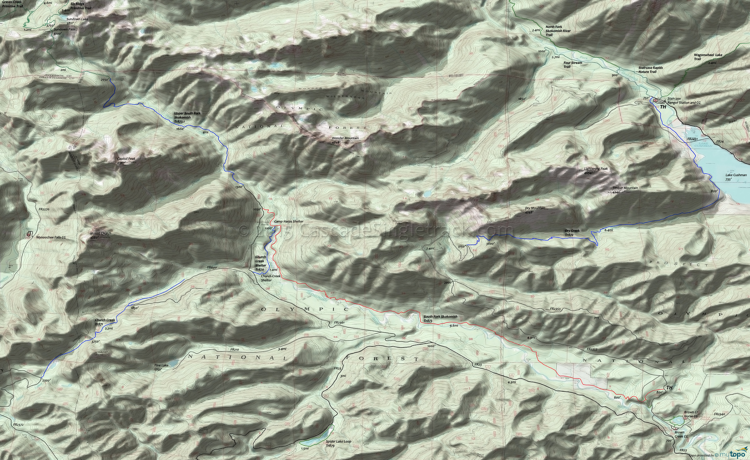
Jefferson Pass Trail 800 and Lower South Fork Skokomish Trail 873 Area Mountain Biking and Hiking Topo Map
Map includes: Church Creek Trail 871, Dry Creek Trail 872, Four Stream Trail, Lower South Fork Skokomish Trail 873, Spider Lake Loop Trail 879, Staircase Rapids Nature Trail Loop Mountain Biking and Hiking Trails.
Olympic Elk reside in the river basin and the ride offers many scenic views. The first 6mi of trail offers some of the finest remaining ancient forest in the Northwest, passing the old LeBar Claim, Church Creek Shelter and Harps Shelter along the way.
Nearby: Church Creek Shelter Tr870 is open to biking but favored by equestrians, and Laney Camp hikers. The 2mi Church Creek Tr871 is open to biking, maybe as a spur ride or something else to try if camping in the area. The trail ascends Church Creek, surrounded by old growth trees, crosses a Chapel Peak saddle then passes one of the Satsop Lakes, to the FR2372 TH.
The 7.6mi (3300' ascent) Dry Creek Tr872 is also open to biking, but expect to encounter many hikers from the Lake Cushman and Staircase CG area. From the Staircase CG, the trail meanders 1mi to FR2451, then 1.4mi alongside Lake Cushman (crossing some private land, shown in white on the topo map, so please stay on the trail). The trail then bears right and follows Dry Creek, ascending 700' in the first mile, then crossing relatively flat terrain to the 4.6mi creek crossing, followed by a 1mi, 800' ascent then a more gradual climb to the 7mi Dry Mountain saddle, before descending .7mi to the FR200 TH.
The 2.7mi Pine Lake Tr887.1 is the abandoned FR210, a quiet spur hike or bike option, away from the summer crowds.
TH: Descend to the river, passing the alternate TH on the right at .5mi.
3.9mi: After some river lowland riding and several creek crossings, ascend the hillside cross a bridge, then continue the gradual ascent.
8mi: After a number of short but steep hillside ascents, pass Laney Camp on the left and continue to the Church Creek Shelter Tr870 intersection.
9.6mi: Pass Church Creek Shelter Tr870 at 9mi (a common turnaround point), with an option to continue the final ascent to FR2361. The section of trail from the end of FR2361 to the park boundary is much more primitive and not suitable for riding.
Draggable map: Map window adjusts to screen size and will respond to touch control. Use scrollbar for mouse control.
No Map? Browser settings and some browser extensions can prevent the maps from appearing. Please see Site Tech


