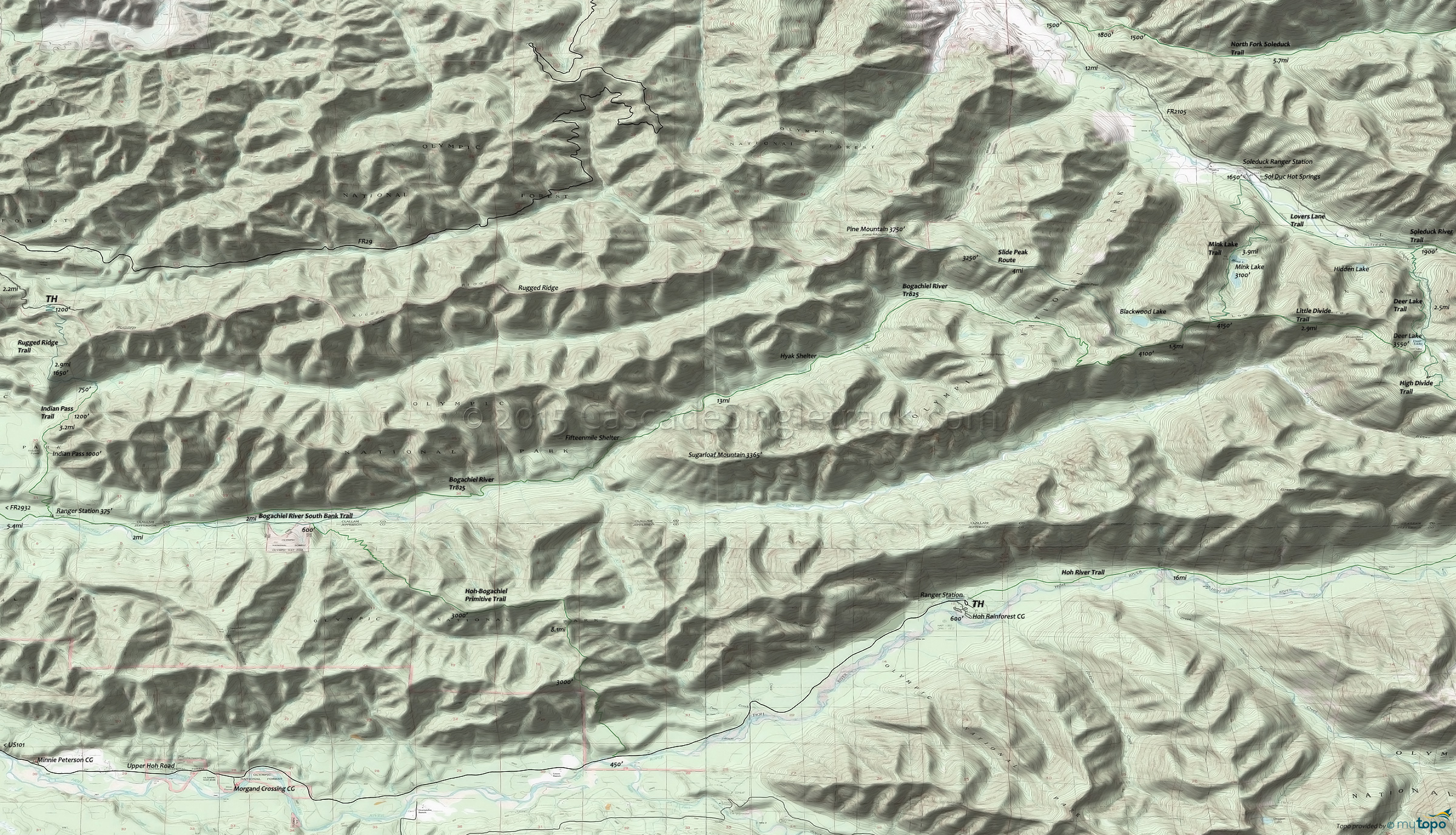
Bogachiel River Trail 825 and Rugged Ridge Trail Area Hiking Topo Map
Map includes: Aurora Ridge Trail, Bogachiel River Trail 825, Bogachiel River South Bank Trail, Hoh-Bogachiel Primitive Trail, Indian Pass Trail, Rugged Ridge Trail Hiking Trails.
The Bogachiel and Hoh rain forest vallys are the wildest and wettest in the Northwest, with both trails leading to Mount Olympus' western flanks, and long enough to suit a variety of hiking experiences.
The 23.5mi (6100' ascent, with 3000' ascent in the first 18mi) Bogachiel River trail is so long it is not entirely shown on the topo map. From Forks, go south on US101 to Bogachiel State Park, then go left onto FR2932 (Bogachiel River Road) and continue for 4mi to the TH parking area on the right.
Nearby Indian Pass Trail and Rugged Ridge Trail create a shuttle possibility for those seeking a shorter, low elevation (but still challenging) hike.
Expect to get wet and bring suitable gear to handle the heavy rainfall on the Pacific (i.e. wet) side of Mount Olympus.
Further to the south, the 15mi (1000') Queets River Trail offers a valley hike to the Pelton Creek Shelter, on the south side of Mount Olympus.
Draggable map: Map window adjusts to screen size and will respond to touch control. Use scrollbar for mouse control.
No Map? Browser settings and some browser extensions can prevent the maps from appearing. Please see Site Tech


