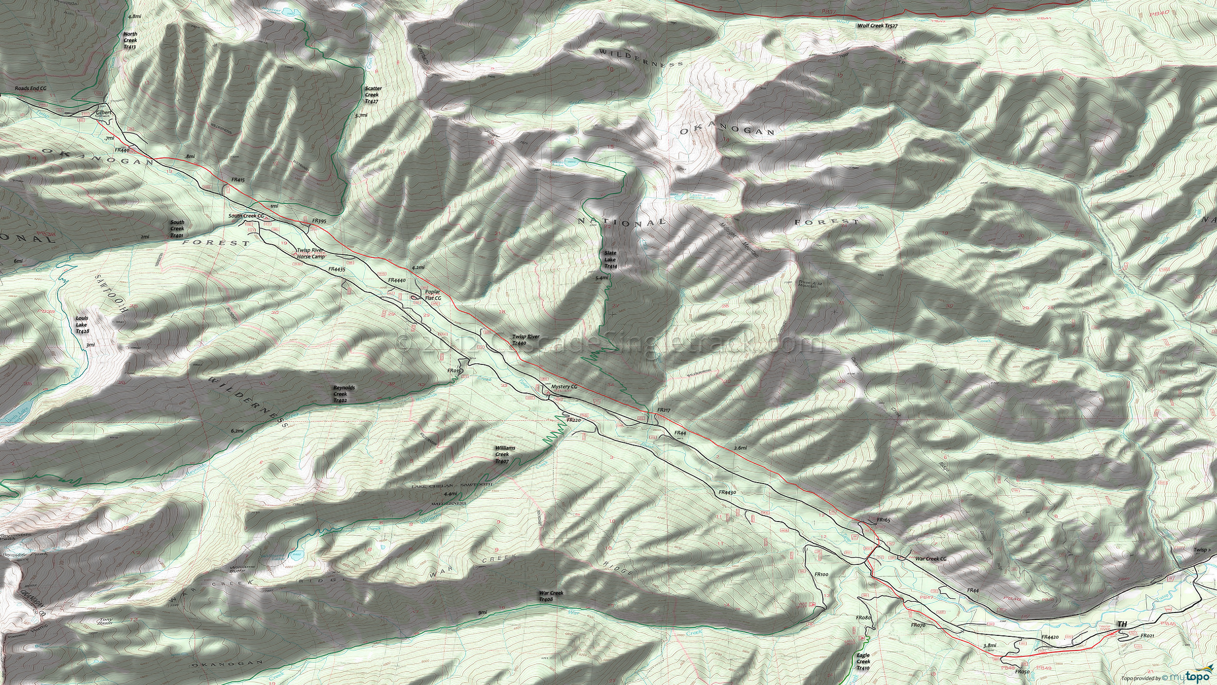
Twisp River Trail 440 Area Mountain Biking and Hiking Topo Map
Map includes: Louis Lake Trail 428, Reynolds Creek Trail 402, Scatter Creek Trail 427, Slate Lake Trail 414, Twisp River Trail 440, War Creek Trail 408, Williams Creek Trail 407 Mountain Biking and Hiking Trails.
TH: Climb the 300' hillside traverse from the Twisp River TH, then cross Scaffold Camp creek and FR050 at 1.2mi. Continue descending to a creek and FR070 crossing at 2mi, with a few switchbacks along the way. Cross Eagle creek then FR080 at 2.6mi, with a brief ascent then descent to FR4420 at 3.4mi.
3.8mi: Ride FR4430 to FR44, then traverse the hillside, crossing FR163 and FR165. Cross a small creek at 4.4mi and 5.3mi, then cross Cook creek at 6.1mi, while continuing to traverse the hillside in a steady ascent. Descend slightly from Cook creek and cross another creek at 6.5mi, then pass the FR217 intersection at 6.9mi.
6.9mi: Cross Slate creek then Slate Lake Tr414. Continue moderate ascent, which peaks at 7.9mi near the Mystery CG. After a slight descent, cross a creek at 8.4mi, then ascend the increasingly technical terrain to the 9.5mi Whistling creek crossing.
10mi: Pass the Poplar Flat CG and cross two creeks, then cross another creek at 10.5mi. Cross Scatter creek at 11.1mi, then pass the FR395 intersection. Cross a creek then cross the Scatter Creek Tr427 intersection at 11.8mi, with a steep ascent and 4 more creek crossings before crossing FR4440 at 13mi.
13.3mi: Pass the FR440 intersection on the right, then cross 3 creeks before reaching FR360 in Gilbert. Return to the TH.
Draggable map: Map window adjusts to screen size and will respond to touch control. Use scrollbar for mouse control.
No Map? Browser settings and some browser extensions can prevent the maps from appearing. Please see Site Tech


