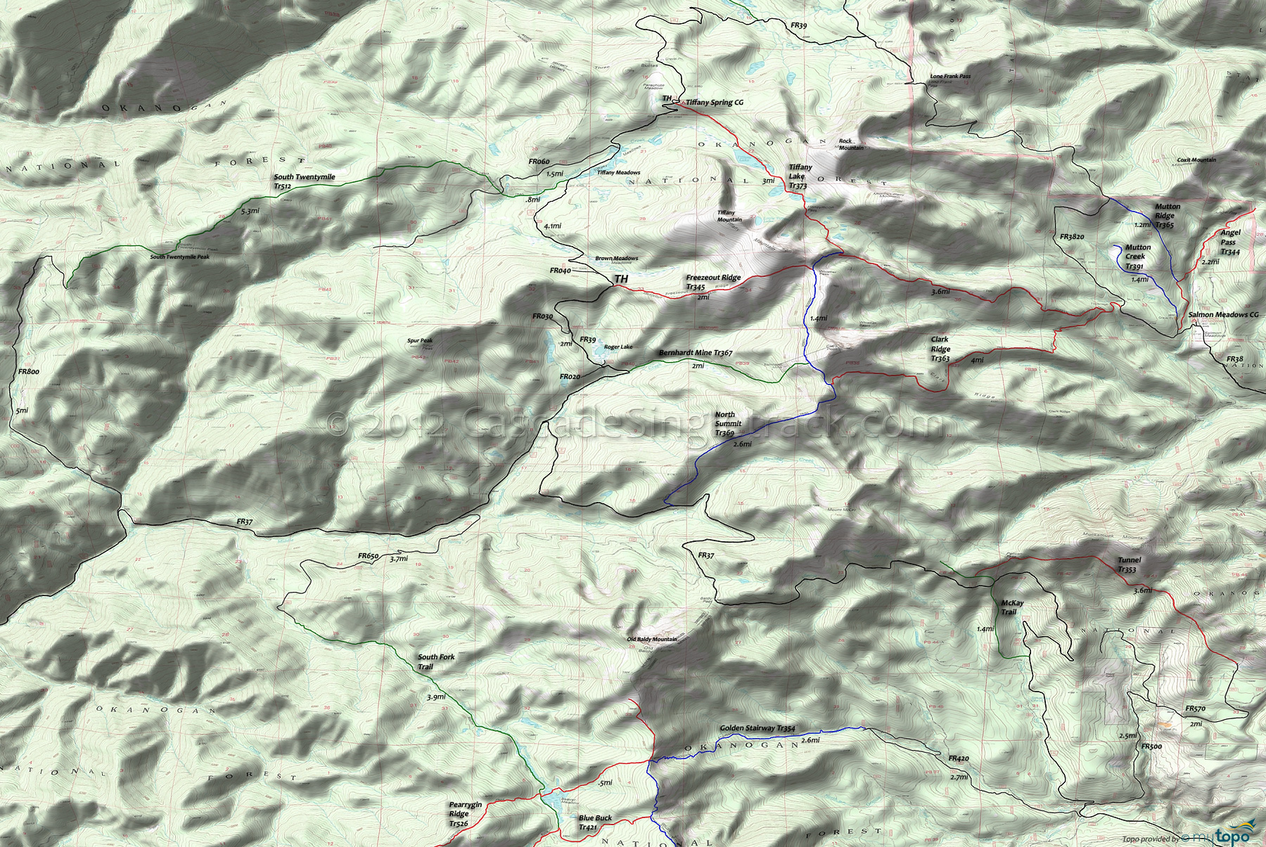
Tiffany Lake Trail 373 and Bernhardt Mine Trail 367 Area Mountain Biking and Hiking Topo Map
Map includes: Angel Pass Trail 344, Bernhardt Mine Trail 367, Clark Ridge Trail 363, Freezeout Ridge Trail 345, Mutton Ridge Trail 365, North Summit Trail 369, South Twentymile Trail 512, Tiffany Lake Trail 373, Tunnel Trail 353 Mountain Biking and Hiking Trails.
TH: From the Roger Lake FR025 TH (near the Bernhardt Mine Tr367 TH) ascend FR39 past the Freezeout Ridge Tr345 TH, then descend past Brown Meadows before the ascent to the Tiffany Springs CG.
6.1mi: Just past the CG go right onto Tiffany Lake Tr373, with an easy descent past Tiffany Lake followed by an increasingly tougher grind to the 8.2mi Honeymoon Pass. Descend from the pass to the North Fork Salmon Creek headwaters, then at 8.7mi hike-a-bike the very steep hillside to the North Summit Tr369 intersection.
9mi: Go right onto North Summit Tr369 continue the steep ascent to the 9.5mi Whistler Pass ride summit at the Freezeout Ridge Tr345 intersection, then traverse the moderate Clark Peak hillside terrain to the Bernhardt Mine Tr367 intersection.
10.8mi: Go right onto Bernhardt Mine Tr367 and descend 1000' in .7mi (a 27% grade). After a slightly more moderate descent, cross Bernhardt Creek at 12.4mi then descend to the TH.
Draggable map: Map window adjusts to screen size and will respond to touch control. Use scrollbar for mouse control.
No Map? Browser settings and some browser extensions can prevent the maps from appearing. Please see Site Tech


