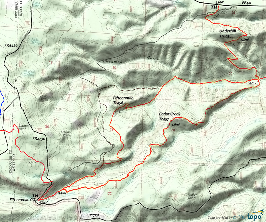
Cedar Creek Trail 457, Fifteenmile Trail 456 and Underhill Trail 683 Loop Mountain Biking and Hiking Topo Map
Underhill, Fifteenmile, Cedar Creek CCW Loop
From the upper TH: Ride out of the campground on Fifteenmile Tr456, to the Cedar Creek Tr457 intersection, then go right over the log bridge. Ride Cedar Creek Tr457 over undulating terrain to the gravel road.
3.7mi: Cross the road. After a mile the trail becomes steep and loose, all the way to the Fifteenmile Tr456 intersection.
5.2mi: Turn left at the T intersection and ascend Fifteenmile Tr456, with a very steep climb/hike-a-bike in the last 2 miles. Fifteenmile continues for 3 more miles past the intersection.
Draggable map: Map window adjusts to screen size and will respond to touch control. Use scrollbar for mouse control.
No Map? Browser settings and some browser extensions can prevent the maps from appearing. Please see Site Tech


