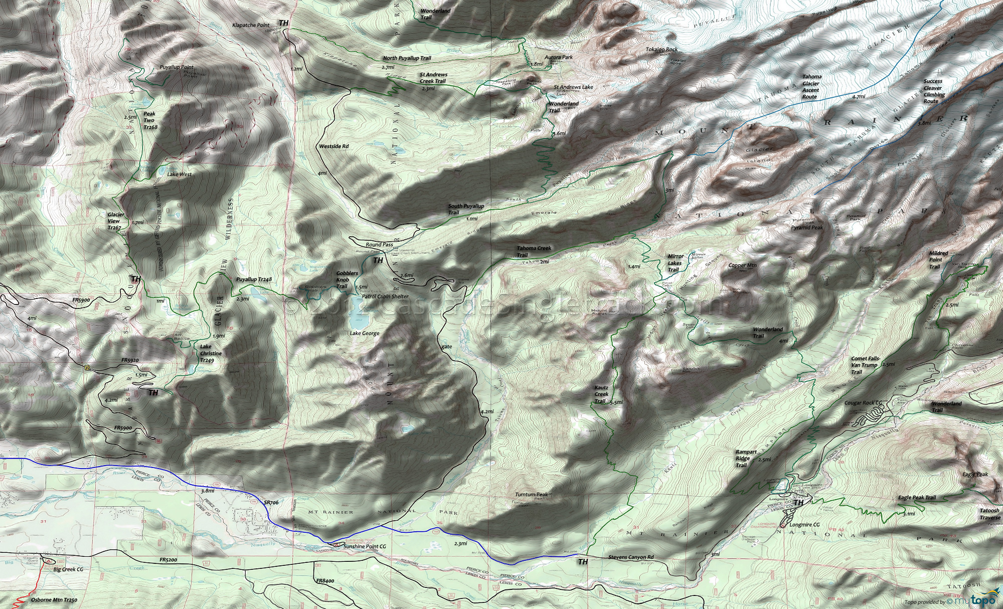
Mount Rainier: Puyallup Trail 248 and Wonderland Trail Area Hiking Topo Map
Map includes: Comet Falls-Van Trump Trail, Eagle Peak Trail, Glacier View Trail 267, Gobblers Knob Trail, Kautz Creek Trail, Lake Christine Trail 249, Peak Two Trail 268, Puyallup Trail 248, Rampart Ridge Trail, Tahoma Creek Trail and Wonderland Trail Hiking Trails.
The southwestern flank of Mount Rainier contains some easily accessible but very challenging day-hikes.
See the Allen Mountain Tr269 page for the more family-oriented Paradise Park trails.
Gobblers Knob Trail accesses the Glacier View Wilderness from the Westside Rd, leading to the Gobblers Knob rock outcrop at the north end of Mount Wow ('goat'), near the pristine Lake George. The Lake George section of this hike is easy enough for families with small children. Lake George has permit-campsites, available park-wide from wilderness information centers, ranger stations, and visitor centers.
Westside road is gated at 3mi, just prior to Tahoma Creek, and FR5900 is gated just past the FR5920 intersection, so expect to hike to most of the west side trailheads.
From Longmire, Comet Falls-Van Trump Trail and Rampart Ridge Trail form a natural loop from Christine Falls to Longmire Meadow. The hike to the 320' Comet Falls is popular, often overwhelming the small Comet Falls trailhead, so consider a shuttle or some Plan B hike. Look for marmots and pikas on the rocky slopes. Trail of The Shadows circumnavigates Longmire Meadow is a short hike suitable for families with smaller children.
Eagle Peak Trail is a good alternative to the Comet Falls-Van Trump-Rampart Ridge loop. Park near the Longmire Museum or National Park Inn and walk to the trailhead, 50' beyond the bridge on the left. Ascend 2mi through steep switchbacks and dense, virgin forest to a small stream, then one more mile to the meadow. The final .5mi ascent to the 5700 ft. Eagle Peak-Chutla Peak saddle intersection with Tatoosh Traverse is steep and challenging.
Wonderland Trail is 93mi and circumnavigates Mount Rainier, crossing varied terrain, from lowland forests to high alpine. The northwestern section of Wonderland Trail is covered on the Christoff Tr1171 page.
For much more information, check out the Mount Rainier National Park Trail guide, which includes descriptions of all trails and a variety of maps.
Draggable map: Map window adjusts to screen size and will respond to touch control. Use scrollbar for mouse control.
No Map? Browser settings and some browser extensions can prevent the maps from appearing. Please see Site Tech


