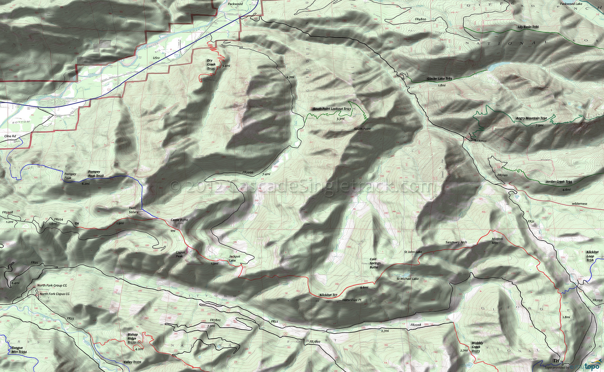
Klickitat Trail 7 Area Mountain Biking and Hiking Topo Map
Map includes Cispus Lookout Trail 127, Dry Creek Trail 125, Glacier Lake Trail 89, Klickitat Trail 7, Pompey Peak Trail 128, South Point Lookout Trail 123 and Wobbly Creek Trail 273 Mountain Biking and Hiking Trails.
TH: Climb the first mile, then begin a series of 100'-200' elevation changes that define this ride. Pass Klickitat Loop Tr7A at 2mi.
4.5mi: At Mission Mountain, begin .7mi, 600' Sanctuary Arch ascent, followed by a fast 760' descent.
6.4mi: Pass St John Lake at the midpoint of a 1mi climb.
9.4mi: The ridgeline extends .6mi past Horseshoe Point (the turnaround point), or continue on to Jackpot Lake, Cispus Point and then to Pompey Peak on Pompey Pk Tr128. At some point, turn around and head back to the TH.
Draggable map: Map window adjusts to screen size and will respond to touch control. Use scrollbar for mouse control.
No Map? Browser settings and some browser extensions can prevent the maps from appearing. Please see Site Tech


