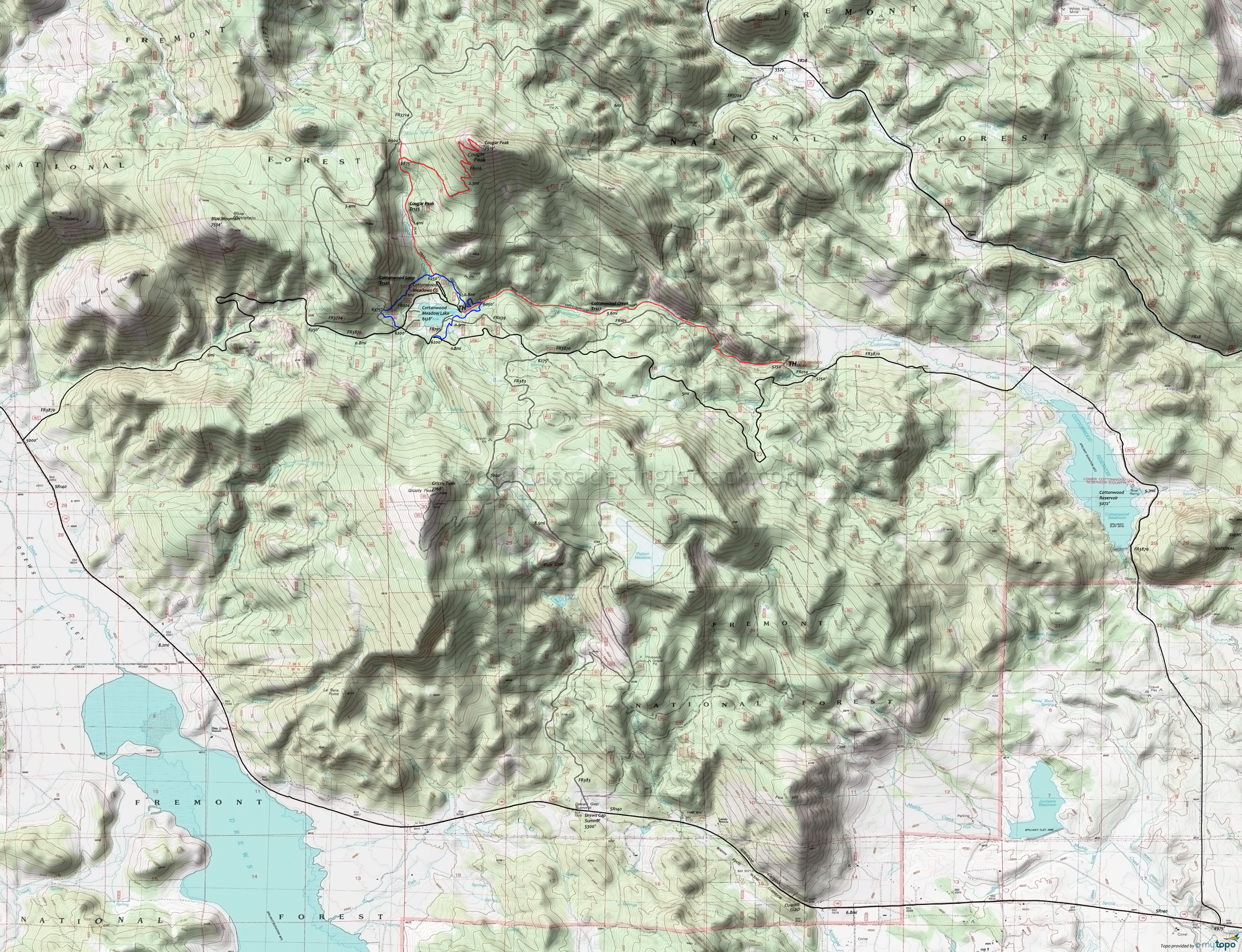
Cottonwood Creek, Cougar Peak Mountain Biking and Hiking Topo Map
Map Includes: Cottonwood Creek Trail 127, Cottonwood Loop Trail 128, Cougar Peak Trail 125 Mountain Biking and Hiking Trails
TH: From the FR014 TH, ascend Cottonwood Creek Tr127, crossing the creek several times, including some side draingaes. Pass FR101 at 1.8mi
3.5mi: Go left at the Cottonwood Loop Tr128 intersection, cross FR039 on the way to joining FR3870 at 4.4mi.
4.8mi: Exit FR3870 at the intersection to the FR024 Cottonwood Meadows CG entrance. Ascend the hillside to FR013 (the ride summit unless ascending Cougar Peak Tr125) then traverse to the Cougar Peak Tr125 intersection.
5.9mi: Option: ascend the 3.7mi/1650' Cougar Peak Tr125 to the summit, or just to the FR3724 connector, then return to Cottonwood Loop Tr128.
6.7mi: Go left onto Cottonwood Creek Tr127 and return to the TH.
Draggable map: Map window adjusts to screen size and will respond to touch control. Use scrollbar for mouse control.
No Map? Browser settings and some browser extensions can prevent the maps from appearing. Please see Site Tech


