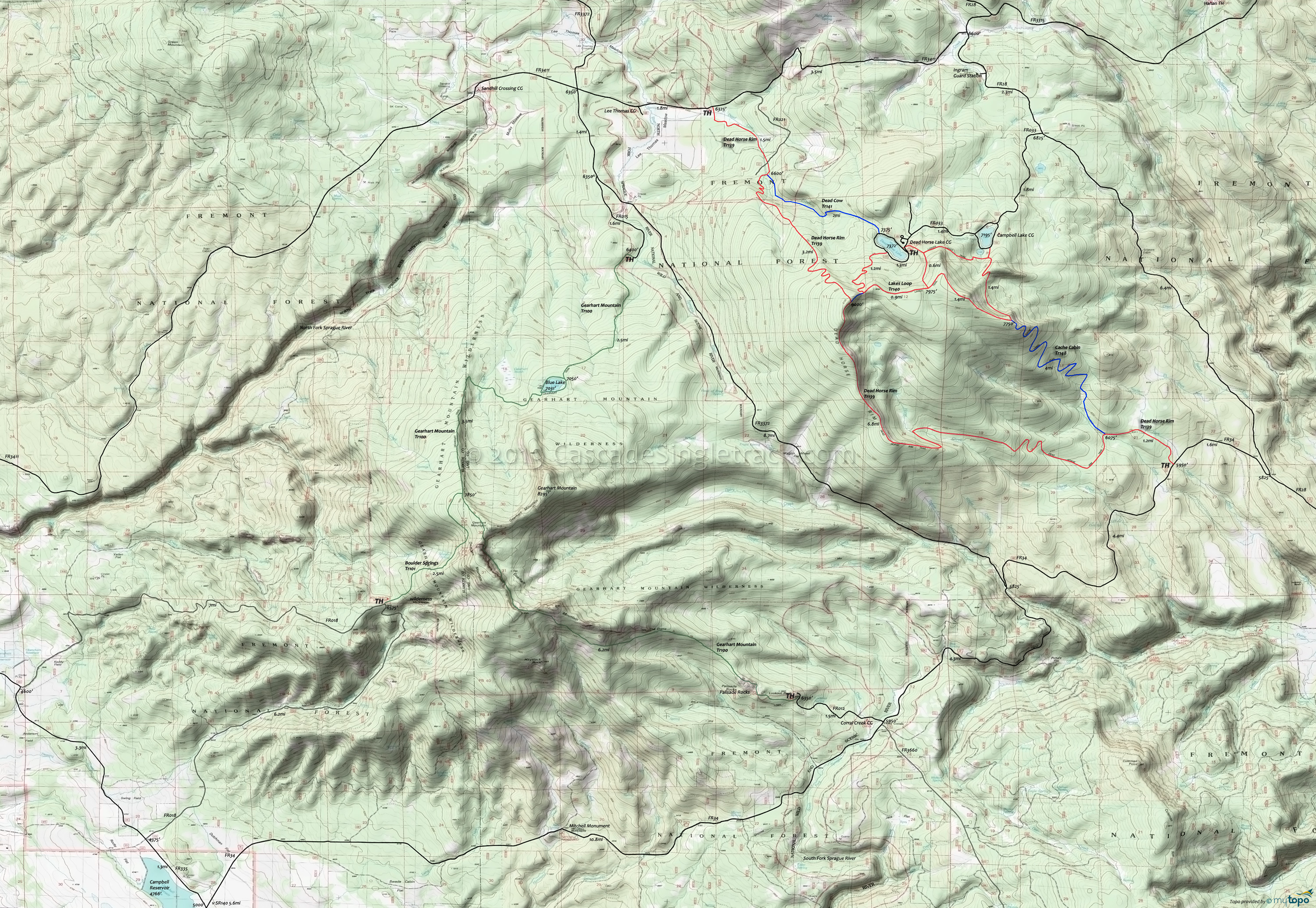
Campbell Lake, Dead Horse Rim Mountain Biking and Hiking Topo Map
Map Includes: Boulder Springs Trail 101, Cache Cabin Trail 148, Dead Cow Trail 141, Dead Horse Rim Trail 139, Gearhart Mountain Trail 100, Lakes Loop Trail 140 Mountain Biking and Hiking Trails
Note: The ride can be shortened at this point by taking Lakes Loop Tr140 to Cache Cabin Tr148 and Dead Horse Rim Tr139 back to the FR34 TH.
8mi: Descend from the rim through switchbacks, crossing Dead Cow Creek twice, then go right onto Dead Cow Tr141.
11.2mi: Ascend Dead Cow Tr141 2mi to Dead Horse Lake. Continue on the road to the Lakes Loop Tr140 TH. Ride towards Campbell Lake, then go right, through a notch and on to Cache Cabin Tr148 (the second ride summit).
16.1mi: Go left onto Cache Cabin Tr148 and descend 4mi through a series of switchbacks, to Dead Horse Rim Tr139 and back to the FR34 TH.
This route is designed to have the primary ascent at the start of the ride, although Lakes Loop Tr140 involves a second ascent. Starting from the Lee Thomas TH could use Lakes Loop Tr140 and Dead Cow Tr141 as a short loop. Another option is to shuttle from Lee Thomas TH to FR34.
Draggable map: Map window adjusts to screen size and will respond to touch control. Use scrollbar for mouse control.
No Map? Browser settings and some browser extensions can prevent the maps from appearing. Please see Site Tech


