Twitter Search
#OregonTimberTrail
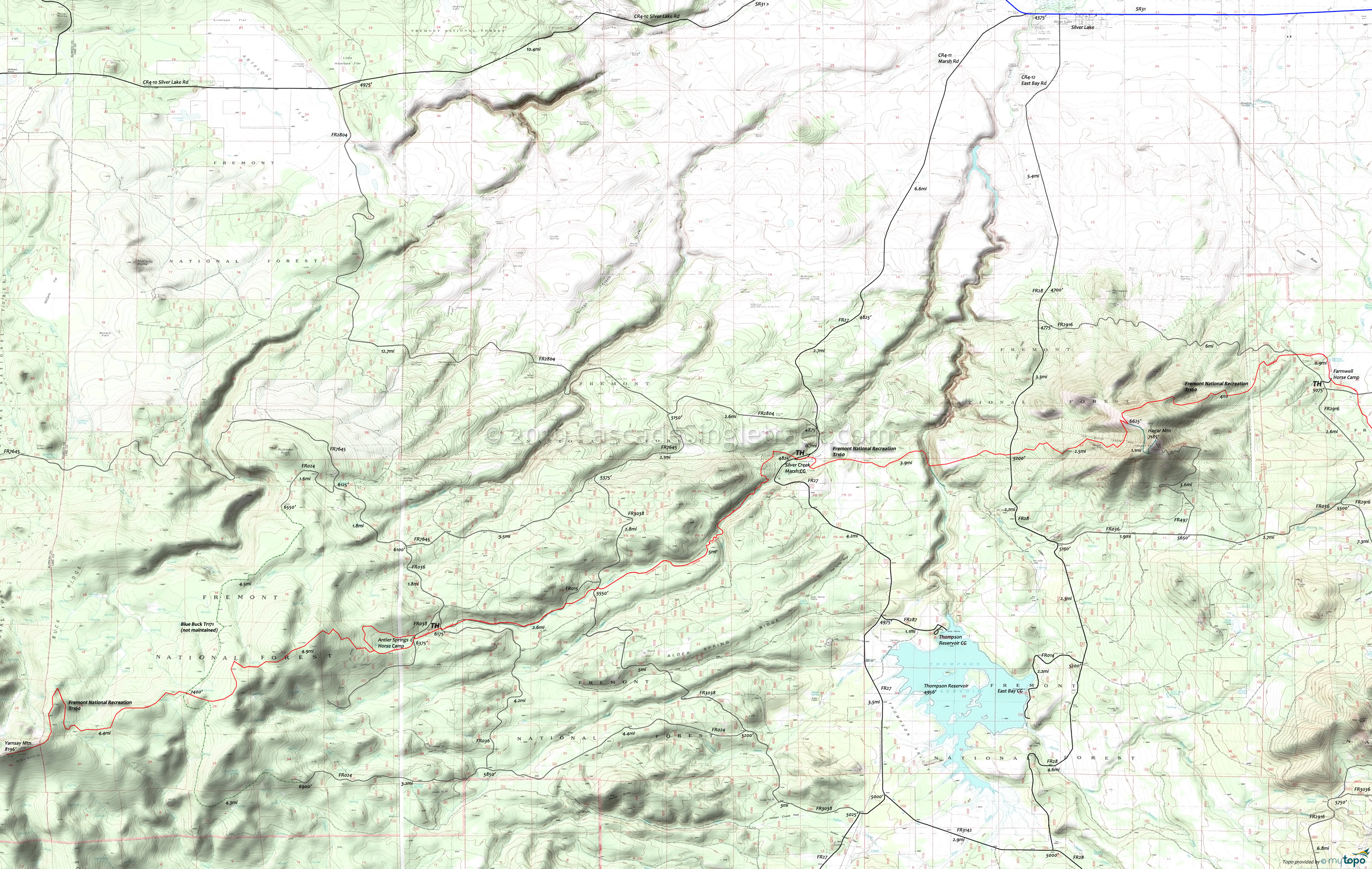
Antler Springs Area Mountain Biking and Hiking Topo Map
Oregon Timber Trail: The Fremont National Recreational Trail is part of the Fremont Tier route.
TH: From the Antler Springs Horse Camp, cross Silver Creek and ascend 2mi to the Yamsay Mountain plateau, passing the Antler Springs loop at 0.7mi.
4.7mi: After passing several knolls, cross the intersection with the unmaintained Blue Buck Tr171. Continue a gradual ascent for 2mi to the large switchback on the eastern flank of Yamsay Mountain.
6.7mi: Traverse 1mi to the switchback then ascend to the summit ridgeline, continuing to the summit.
9.2mi: Enjoy the view of Mount Shasta, the Fort Rock Basin, and the Cascade Range. Return to the TH. Note: There is an unmaintained XC Ski trail which extends from the summit to the west.
Draggable map: Map window adjusts to screen size and will respond to touch control. Use scrollbar for mouse control.
No Map? Browser settings and some browser extensions can prevent the maps from appearing. Please see Site Tech


