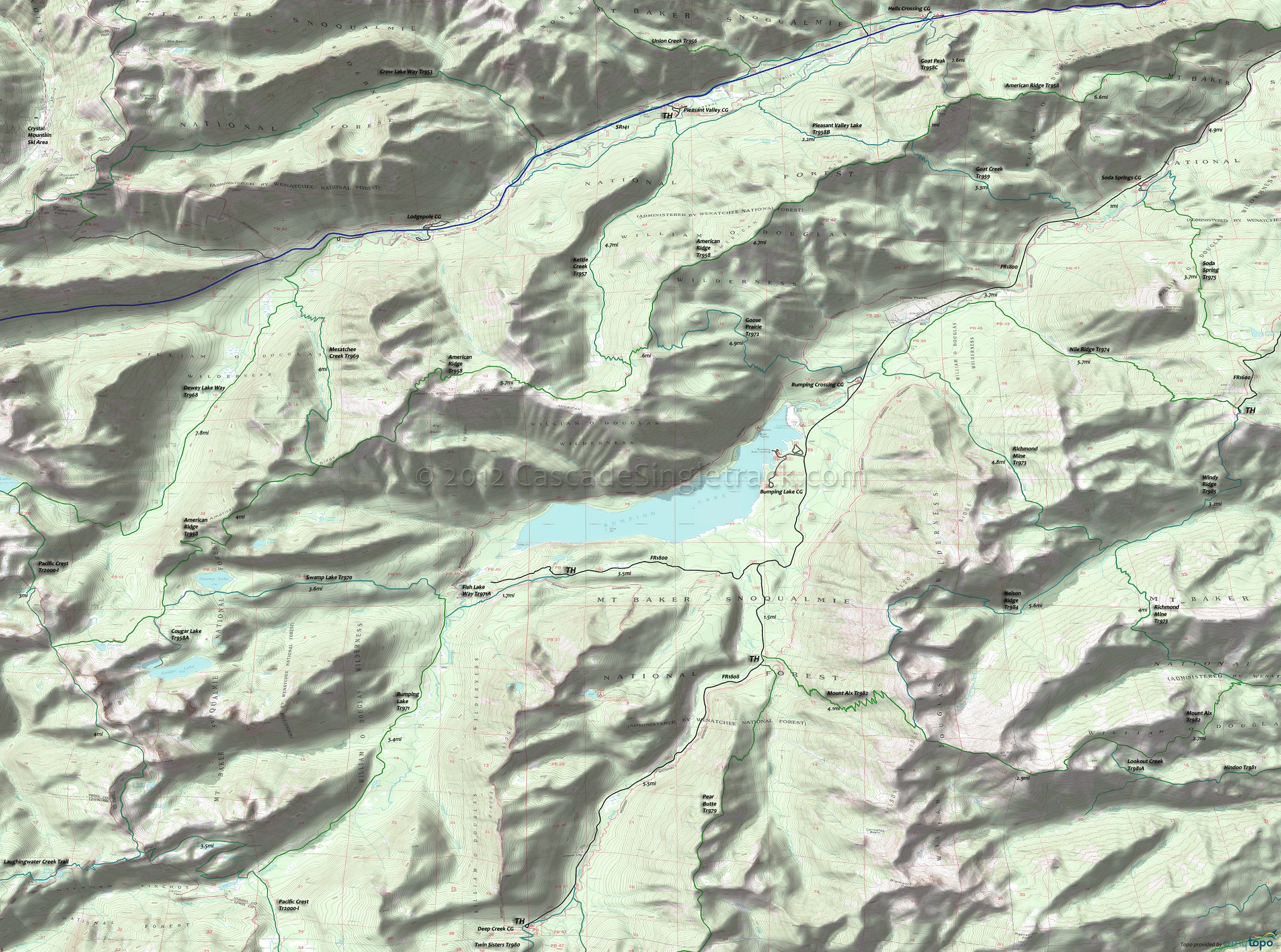
American Ridge Trail, Bumping Lake Trail and Pacific Crest Trail Area Hiking Topo Map
Twitter Search
#PacificCrestTrail
Map includes: American Ridge Trail 958, Bumping Lake Trail 971, Dewey Lake Way Trail 968, Goat Creek Trail 959, Goose Prairie Trail 972, Kettle Creek Trail 957, Mesatchee Creek Trail 969, Mount Aix Trail 982, Nelson Ridge Trail 984, Nile Ridge Trail 974, Pacific Crest Trail 2000-I, Richmond Mine Trail 973 and Swamp Lake Trail 970 Hiking Trails.
William O Douglas Bumping Lake Area Hiking: Bounded by SR410 to the north and Pacific Crest Tr2000-I to the west, the easily accessible Bumping Lake area is perfect for day hiking, with loop options for most skill levels.
North of Bumping Lake, American Ridge Tr958 is the main East-West connector, with trails leading to SR410 and the Pleasant Valley Loop Tr999, as well as into the Bumping reservoir basin. Either connect some trails into a loop or shuttle between FR1800 and one of the SR410 campgrounds.
To the west, Fish Lake Way Tr971A leads to a Swamp Lake Tr970 - Bumping Lake Tr971 loop around Cougar Lake, with Pacific Crest Tr2000-I as the connector.
The Deep Creek campground trails and Pear Butte Tr979 lead south to Rimrock Lake, covered on the Klickitat Tr7 page.
Mount Aix Tr982 leads to FR1500, the eastern trail boundary.
Draggable map: Map window adjusts to screen size and will respond to touch control. Use scrollbar for mouse control.
No Map? Browser settings and some browser extensions can prevent the maps from appearing. Please see Site Tech


