
South Willamette Area Mountain Biking and Hiking Topo Map
Map includes: Eagles Rest Trail 3461, Eula Ridge Trail 3463, Goodman Creek Trail 3461.1, Hardesty Trail 3469, Lawler Trail 3473, Lost Creek Trail 3462, Sawtooth Trail 1401 and South Willamette Trail 3465 Mountain Biking and Hiking Trails.
TH: Not much to describe for this pleasant roller coaster ride. From the Hardesty TH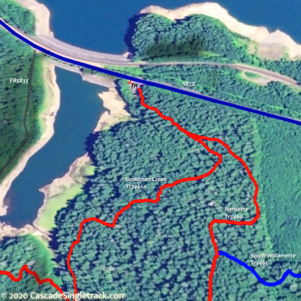
View of the Hardesty TH, ride to the Lawler Tr3473 TH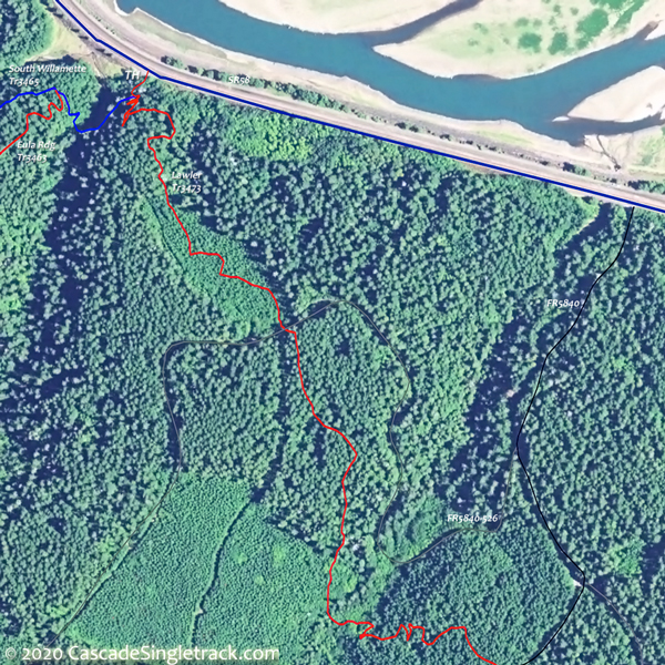
View of the Lawler, Eula Ridge TH and return. Maybe extend the ride with Goodman Creek Tr3461.1 or Lawler Tr3473 for a little more elevation or distance.
1mi: Cross Crale Creek, then cross FR5835 at 1.3mi. Cross FR806 and FR509 then ascend a moderate switchback to FR510 at 2.7mi, cresting the ride summit at 3mi.
3.5mi: Switchback descent to Harper Creek, then switchback ascend a minor ridge, followed by a descent to North Creek at 4.6mi, and merge with Eula Rdg Tr3463 at 4.8mi.

Draggable map: Map window adjusts to screen size and will respond to touch control. Use scrollbar for mouse control.
No Map? Browser settings and some browser extensions can prevent the maps from appearing. Please see Site Tech

