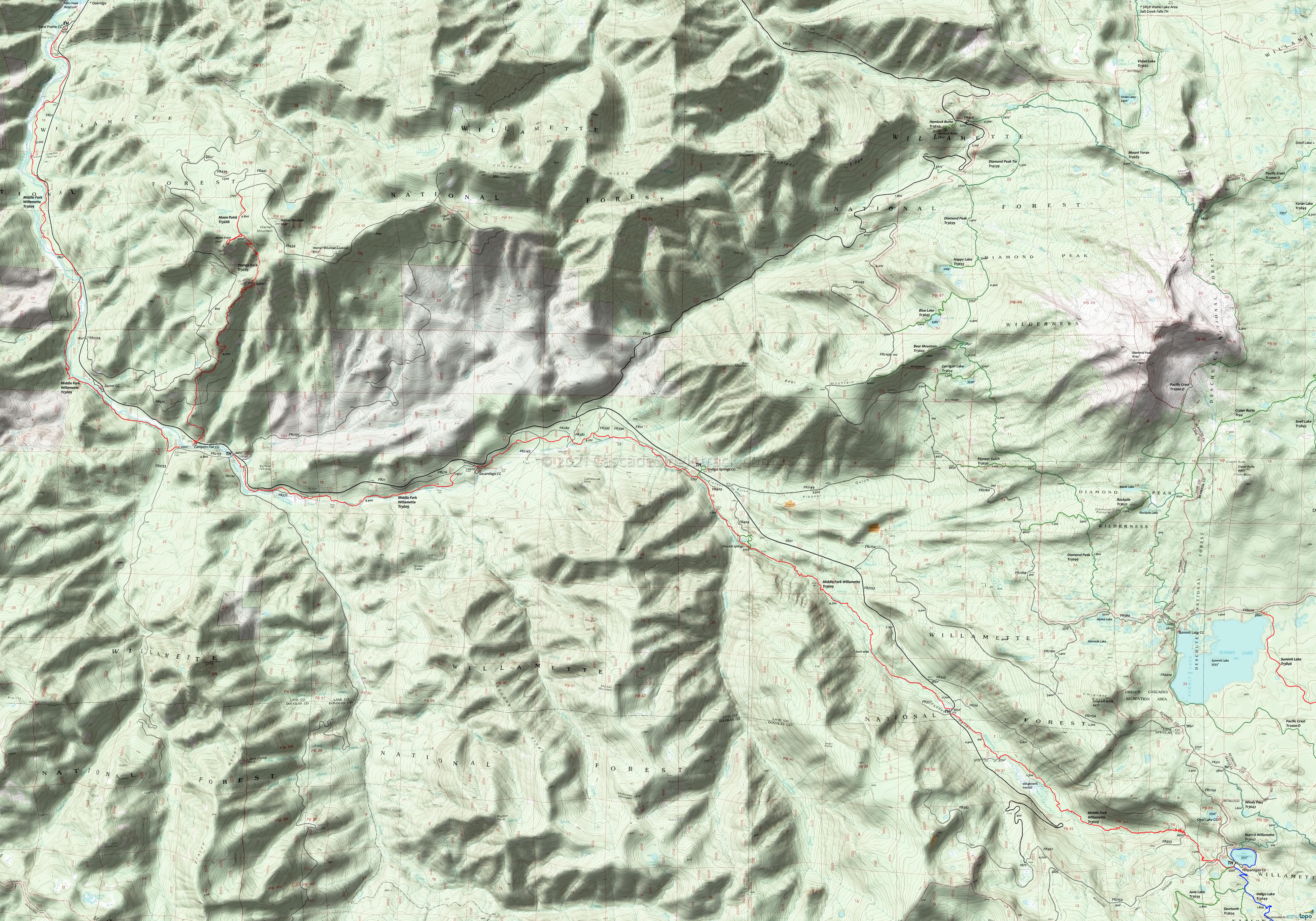
Middle Fork Willamette Area Mountain Biking and Hiking Topo Map
Twitter Search
#PacificCrestTrail
#OregonTimberTrail
Map includes: Indigo Lake Trail 3649, June Lake Trail 3639, Middle Fork Willamette Trail 3609, Moon Point Trail 3688, Pacific Crest Trail 2000-D, Start O Willamette Trail 3642, Timpanogas Lake Trail 3638, Windy Pass Trail 3643 and Youngs Rock Trail 3685 Mountain Biking and Hiking Trails.
Oregon Timber Trail: Middle Fork Willamette Trail 3609 is part of the Willamette Tier route.
Middle Fork Willamette Sand Prairie Campground to Campers Flat Campground OAB
TH: Ride from the south end of the Sand Prairie campground to the gate, then continue on FR017 to the trail (bear right). Cross FR016, then cross the Buck Creek bridge at .6mi. Go around a bend, ride alongside Cone Creek, then cross FR151 at 1.7mi.
2.6mi: Cross FR156, then bear left, cross Estep Falls Creek, then approach FR21 several times over the next .5mi. Ride alongside then cross Pine Creek, then cross FR022 at 3.9mi.
5.2mi: Ride alongside FR21 then ride across the river on FR2127. Parallel FR2125 while crossing FR029, then cross FR032 at 5.9mi.
6mi: The next 2mi of the trail is a little more technical, clinging to the hillside next to the river, with some short climbs over rocky and rooty terrain. Pass Secret campground (across the river) at 7.6mi, just after crossing Indian Creek.
9.2mi: Cross Coal Creek, then turn around at FR2133 at 9.4mi, with an option of taking on Youngs Rock Tr3685 or more of Middle Fork Willamette Tr3609.
Draggable map: Map window adjusts to screen size and will respond to touch control. Use scrollbar for mouse control.
No Map? Browser settings and some browser extensions can prevent the maps from appearing. Please see Site Tech


