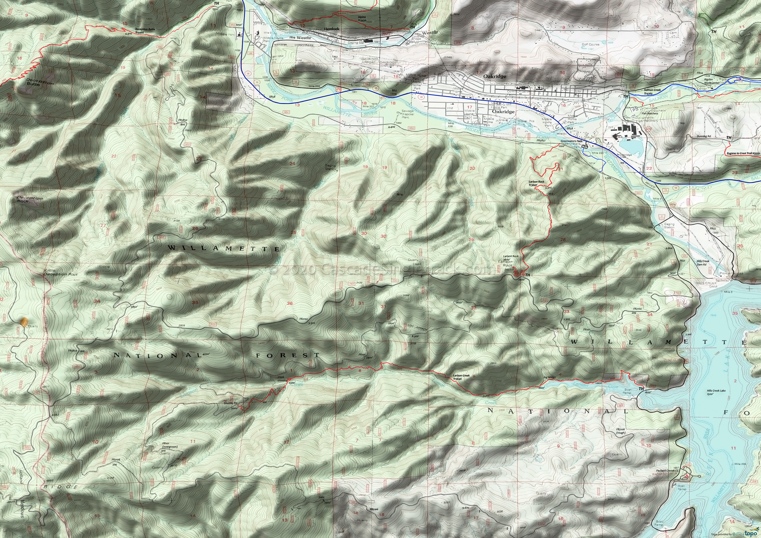
Larison Creek Trail 3646 Mountain Biking and Hiking Topo Map
FR101, Larison Creek CCW Loop
TH: Go north on FR21 2.3mi to FR2101, then climb 1.9mi to FR101.
4.2mi: Go left onto FR101 and continue for 8.3mi through ten creek ravines.
12.6mi: Cross a ridge and go left onto trail. Begin descent. The first mile is steep and can be overgrown with blackberry bushes in July and August, a reminder that sometimes 'biking is bleeding'.
13.7mi: Steep section ends with tapeworm switchbacks down to Larison Creek, followed by several miles of technical, rocks and roots riding.
16.9mi: End of technical riding, into a typical riverside trail.
Draggable map: Map window adjusts to screen size and will respond to touch control. Use scrollbar for mouse control.
No Map? Browser settings and some browser extensions can prevent the maps from appearing. Please see Site Tech


