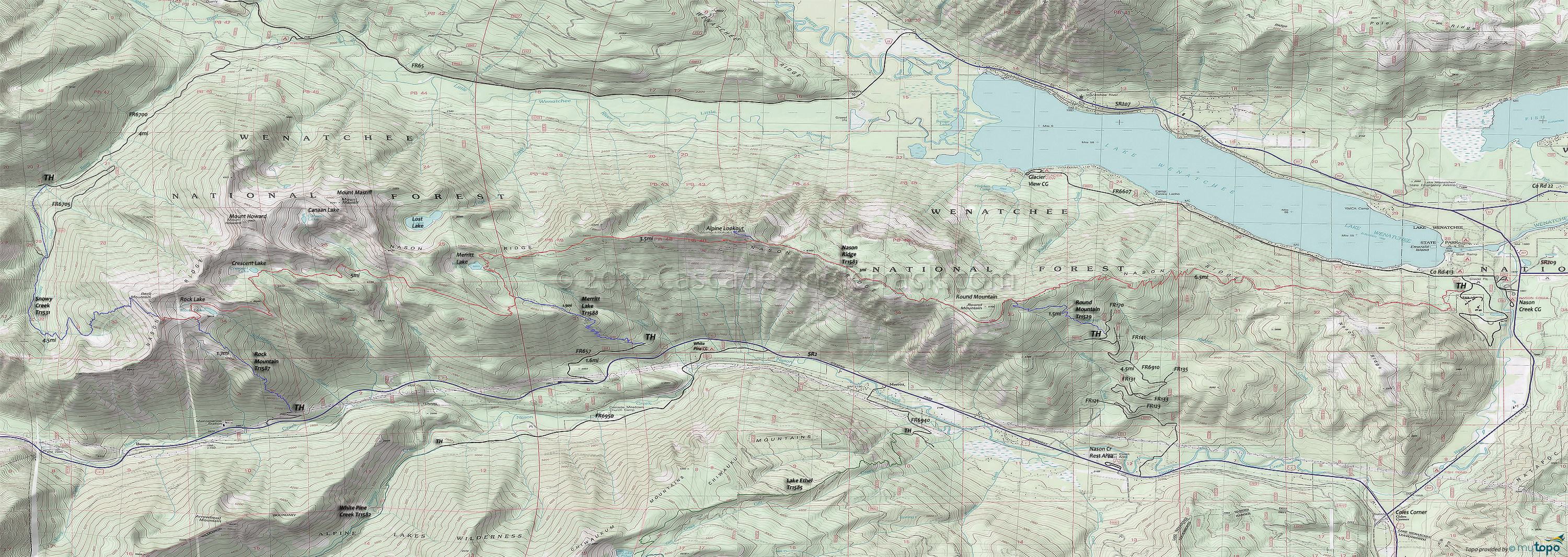
Nason Ridge Trail 1583 and Rock Mountain Trail 1587 Area Mountain Biking and Hiking Topo Map
Map includes: Merritt Lake Trail 1588, Nason Ridge Trail 1583, Rock Mountain Trail 1587, Round Mountain Trail 1529, Snowy Creek Trail 1531 Mountain Biking and Hiking Trails.
TH: Ride through the Lake Wenatchee flats, then begin the Round Mountain ascent.
2.6mi: Pass a 5-way intersection, bearing to the right on some doubletrack. Crest a knoll at 3.2mi, after which the abandoned road turns into a trail again, switchbacking up the ridgeline to a 4.9mi crest.
6.3mi: After some more switchbacks, crest a knoll and pass the Round Mountain Tr1529 intersection on the left (a common turnaround point), then hike-a-bike for .2mi before riding around Round Mountain.
7.3mi: Descend to a saddle then ascend to the 8.4mi ride summit.
9.3mi: Consider turning around at the Alpine Lookout intersection (aka Nine Mile Saddle). The off-ridgeline traversing descent to Merritt Lake is fun but will require some hard climbing to get back to Nine Mile Saddle.
12.8mi: Turnaround at the Merritt Lake Tr1588 intersection, or descend 2mi to SR2 and ride downhill back to SR207 and on to the Nason Creek CG TH.
Draggable map: Map window adjusts to screen size and will respond to touch control. Use scrollbar for mouse control.
No Map? Browser settings and some browser extensions can prevent the maps from appearing. Please see Site Tech


