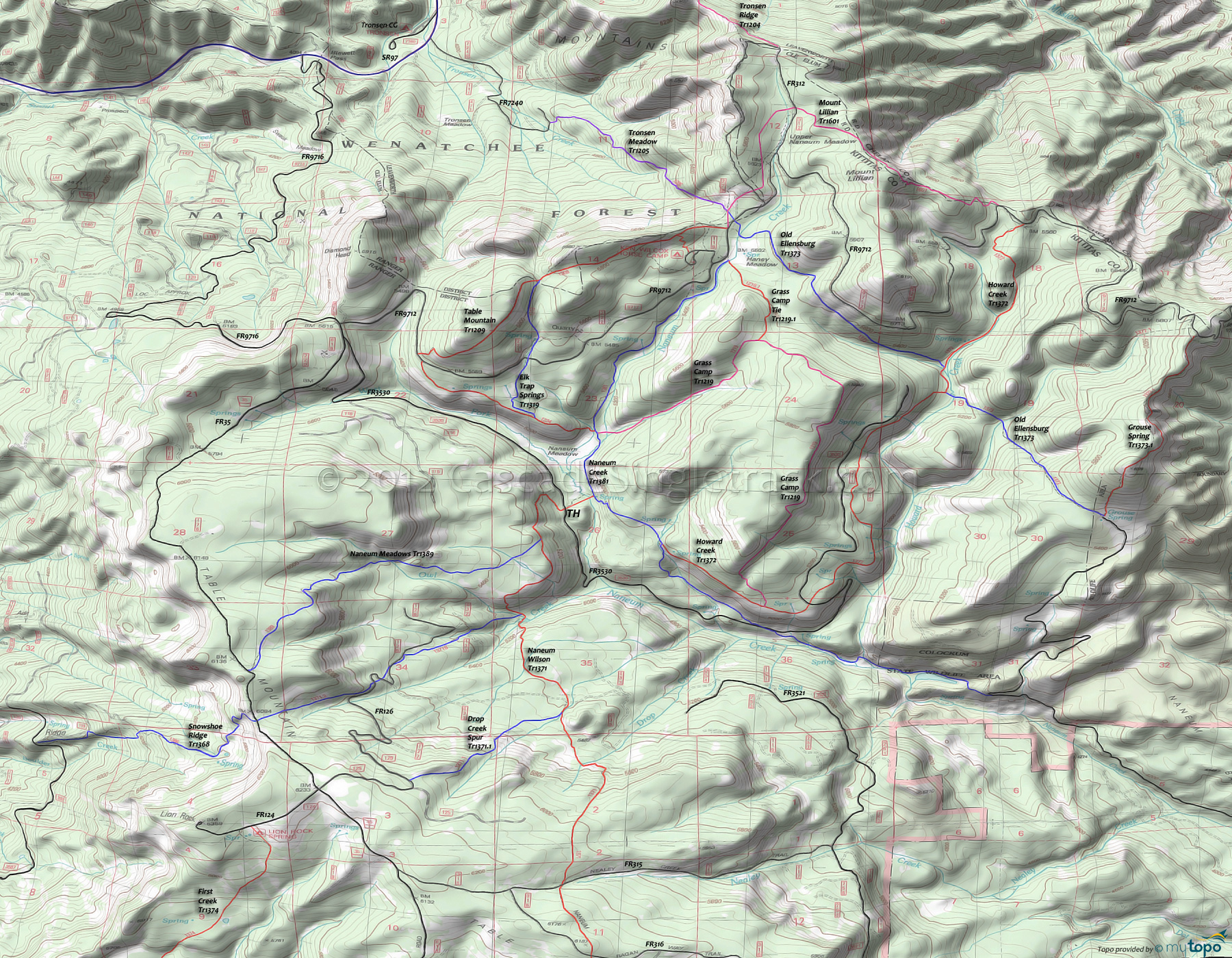
Naneum Creek Trail 1381, Naneum Meadows Trail 1389 and Naneum Rim Trail 1234 Area Mountain Biking and Hiking Topo Map
Map includes: Elk Trap Springs Trail 1319, Grass Camp Trail 1219, Grouse Spring Trail 1373.1, Howard Creek Trail 1372, Mount Lillian Trail 1601, Naneum Creek Trail 1381, Naneum Meadows Trail 1389, Naneum Rim Trail 1234, Old Ellensburg Trail 1373 and Table Mountain Trail 1209 Mountain Biking and Hiking Trails.
The outer loop should be ridden CW and could be further extended by using FR9712 to access Grouse Spring Tr1373.1, returning on FR3521 and Naneum Creek Tr1381.
The main east-west connector, Old Ellensburg Tr1373 crosses Naneum Creek, then crosses Haney Meadow and Howard Creek before ending at Grouse Spring Tr1371.1.
From the Haney Meadow Campground, Mount Lillian Tr1601 crosses Upper Naneum Meadow, then passes Mount Lillian as the trail winds along the ranger district boundary while travelling through old-growth lodgepole pine and passing sandstone outcrops, before ending at FR9712.
Grass Camp Tr1219 forms 3/4 of the inner loop, ascending alongside a small stream to a plateau. Passing through meadows, the trail circles around an experimental 1975 lodgepole forest burn, before passing the Grass Camp Tie Tr1291.1 intersection at 1.2mi. The trail then explores the edge of the plateau, with views of Glacier Peak, before descending to the Howard Creek Tr1372 TH.
Draggable map: Map window adjusts to screen size and will respond to touch control. Use scrollbar for mouse control.
No Map? Browser settings and some browser extensions can prevent the maps from appearing. Please see Site Tech


