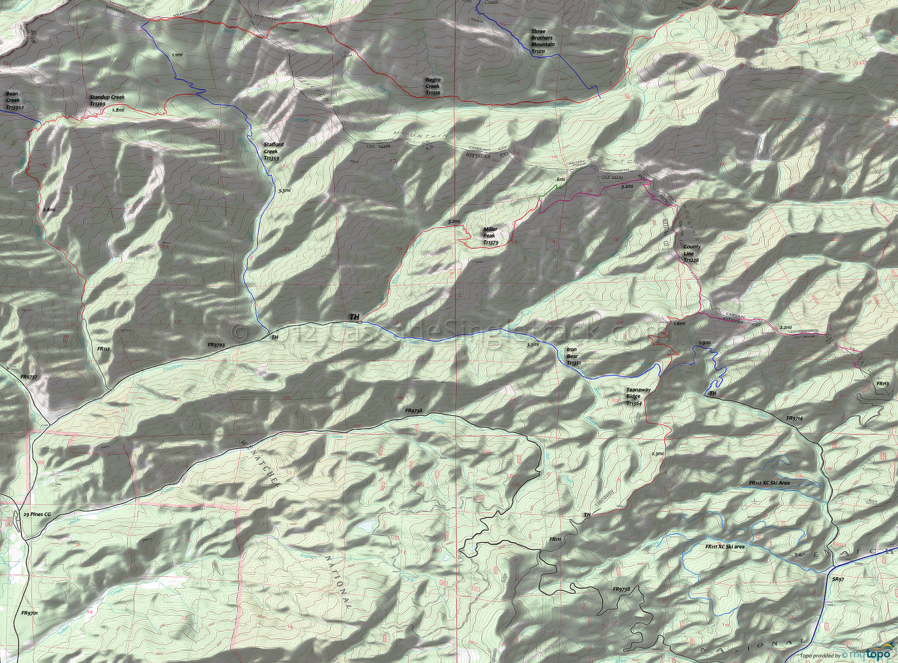
Iron Bear Trail 1351 and Miller Peak Trail 1379 Area Mountain Biking and Hiking Topo Map
Map includes: County Line Trail 1226, Iron Bear Trail 1351, Miller Peak Trail 1379, Stafford Creek Tr1359, Standup Creek Trail 1369 and Teanaway Ridge Trail 1364 Mountain Biking and Hiking Trails.
TH: Go on Iron Bear Tr1351, immediately crossing Miller Creek and another small creek, then cross North Fork Bear Creek at 1.4mi, as the trail follows South Fork Bear Creek to the Teanaway Ridge headwaters. Cross a small creek at 1.9mi, then the trail bends to the left at 2.4mi, to follow a tributary to the ridgeline across increasingly steep terrain. Except for the strongest climbers, expect to hike from 2.7mi to the ridgeline, crossing the steepest terrain of the ride.
3.3mi: Go left onto Teanaway Ridge Tr1364 and (likely) hike-a-bike to the ridgeline summit at 4.5mi, which marks the end of the really serious ascent.
4.9mi: After a brief descent, go left on County Line Tr1226, climb a bit then descend to the FR7322 intersection at 5.6mi. Just past the intersection, the trail merges with doubletrack. Climb the doubletrack, still riding along the county line ridgeline, then bear to the left onto the trail and hike-a-bike to the ridge. See the summit graphic above to get a better idea of this sketchy terrain.
6.3mi: Descend sharply to a ridgeline saddle, then ascend to the eastern Miller Peak ridgeline at 6.9mi, followed by a traverse along the barren southern flank of Miller Peak and the ride summit at 7.4mi.
8.2mi: Crest the southern Miller Peak ridgeline, then go left onto Miller Peak Tr1379, with an option to hike .6mi (735') to the Miller Peak summit.
8.8mi: After a ridgeline descent, drop off the ridge into a very steep, switchback descent to the 9.6mi Miller Creek crossing. Cross several other creeks in a more gradual descent to the TH, passing through the fir and pine forest alongside the fern-lined Miller Creek.
Draggable map: Map window adjusts to screen size and will respond to touch control. Use scrollbar for mouse control.
No Map? Browser settings and some browser extensions can prevent the maps from appearing. Please see Site Tech


