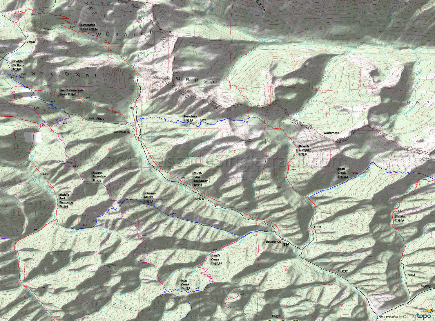
Bean Creek Trail 1391.1 and Iron Peak Trail 1399 Area Mountain Biking and Hiking Topo Map
Map includes: Bean Creek Trail 1391.1, Iron Peak Trail 1399, North Fork Teanaway Trail 1358, Beverly Turnpike Trail 1391, Johnson Medra Trail 1383, Jungle Creek Trail 1383.1, Koppen Mountain Trail 1225, Standup Creek Trail 1369 Mountain Biking and Hiking Trails.
TH: Ride .3mi from the Beverly campground to FR112 and ascend .2mi to the Beverly Turnpike Tr1391. Pass the Bean Creek Tr1391.1 intersection on the right at 1.9mi.
2.8mi: Trail moves away from Beverly Creek and traverses the steep hillside, including a .5mi hike-a-bike switchback section, before crossing Beverly Creek at 4mi.
4.6mi: Go left onto Iron Peak Tr1399 and complete the final Iron Peak saddle ascent, passing the ride summit at 5.1mi. The initial descent is steep, then moderates, before the final switchback plunge to North Fork Teanaway Tr1358.
7.1mi: Cross FR9737 then go left onto North Fork Teanaway Tr1358. Pass the De Roux campground then the trail crosses FR9737 at the Eldorado Creek crossing. Cross another creek at 8.8mi and a dirt road at 8.5mi, with the final creek crossing at 10.5mi. Go left onto FR9737 and return to the TH.
Draggable map: Map window adjusts to screen size and will respond to touch control. Use scrollbar for mouse control.
No Map? Browser settings and some browser extensions can prevent the maps from appearing. Please see Site Tech


