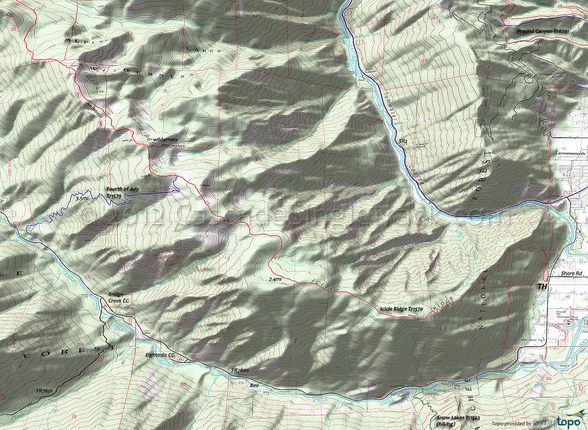
Fourth of July Trail 1579 and Icicle Ridge Trail 1570 Area Mountain Biking and Hiking Topo Map
TH: For those able to manage the climb, do so through the switchback ascent, with 1.6mi of the steepest terrain to reach the ridgeline, followed by 2.4mi of steep ridgeline ascent.
4mi: The ridgeline ascent moderates, crossing several saddles to the 7.1mi ride summit.
7.4mi: Go left on Fourth of July Tr1579 and traverse the hillside to Fourth of July Creek, as the descent intensifies at 8.8mi.
11mi: After crossing Fourth of July Creek twice, go left onto FR76 and ride the slow descent back to the TH.
Draggable map: Map window adjusts to screen size and will respond to touch control. Use scrollbar for mouse control.
No Map? Browser settings and some browser extensions can prevent the maps from appearing. Please see Site Tech


