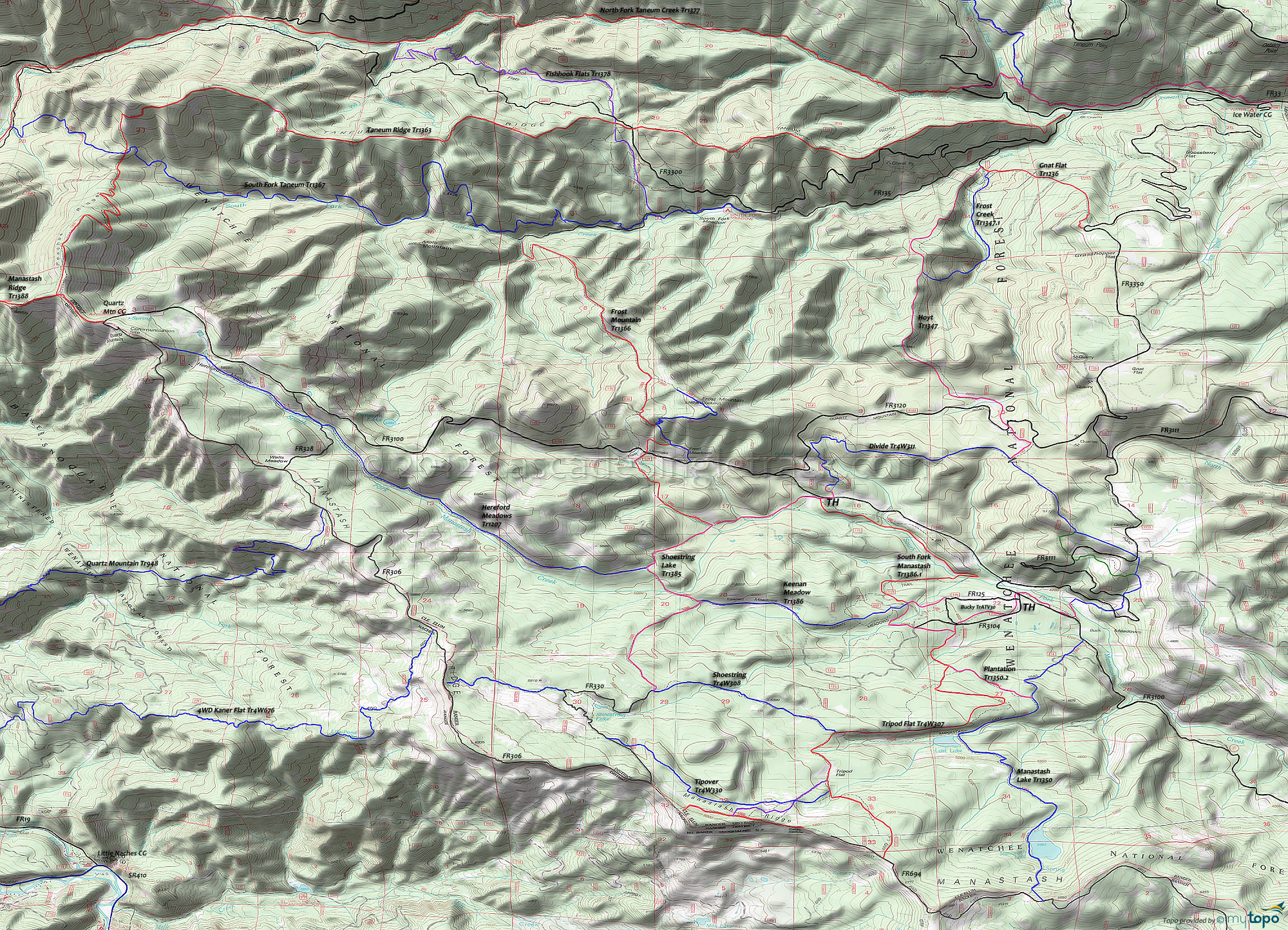
Manastash Lake Trail 1350 and Shoestring Lake Trail 1385 Area Mountain Biking and Hiking Topo Map
Map includes: Frost Creek Trail 1347.1, Frost Mountain Trail 1366, Gnat Flat Trail 1236, Hereford Meadows Trail 1207, Hoyt Trail 1347, Keenan Meadow Trail 1386, Manastash Lake Trail 1350, Rocky Saddle Trail 1384, Shoestring Lake Trail 1385, South Fork Manastash Trail 1386.1 Mountain Biking and Hiking Trails.
As with the rest of the area, all the trails are open to Orv, and with all the camping sites in the area and close proximity to Ellensburg, this is a weekend Orv destination so try to ride these trails during the week is possible and avoid the obvious Orv routes.
As always, trail numbers which include 4W are actually doubletrack or forest roads, such as Shoestring Tr4W308 mostly consisting of FR308.
The zig-zagging Shoestring Lake Tr1385 and Tripod Flat Tr4W307 are the main north-south connectors, with the combination of Keenan Meadow Tr1386 and Hereford Meadows Tr1207 covering the width of this trail system and Manastash Lake Tr1350 at the eastern boundary of the trail system.
Draggable map: Map window adjusts to screen size and will respond to touch control. Use scrollbar for mouse control.
No Map? Browser settings and some browser extensions can prevent the maps from appearing. Please see Site Tech


