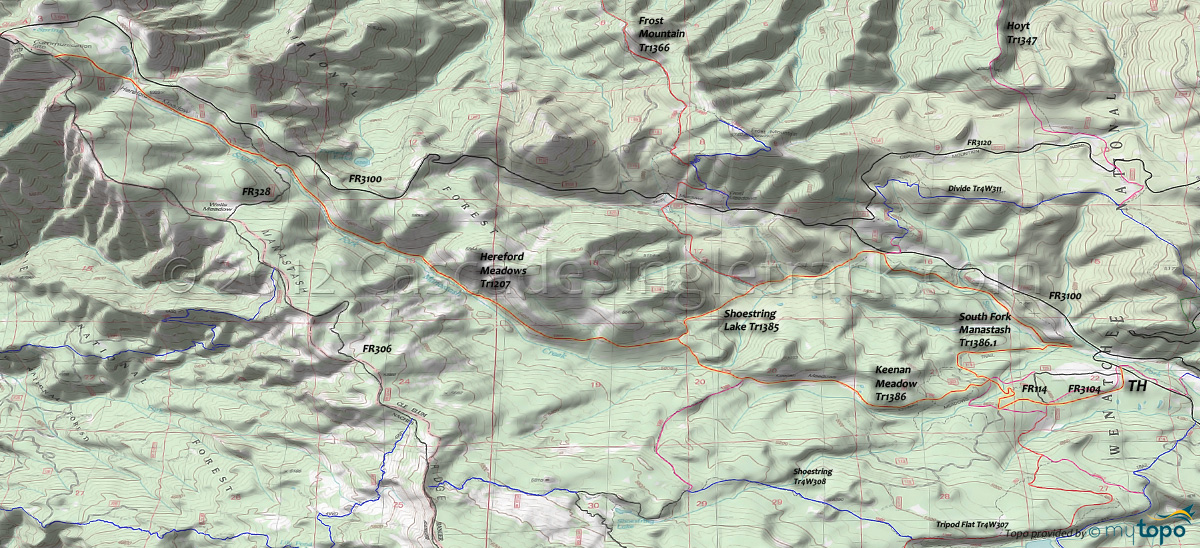
Four Meadows: Hereford Meadows Trail 1207 and Keenan Meadow Trail 1386 Area Mountain Biking and Hiking Topo Map
Map includes: Hereford Meadows Trail 1207, Keenan Meadow Trail 1386, Shoestring Lake Trail 1385, South Fork Manastash Trail 1386.1 Mountain Biking and Hiking Trails.
TH: From the FR3104 TH, ride 1mi to FR114, then go right and go .5mi through a minor descent to the 4-way intersection with Keenan Meadow Tr1386, South Fork Manastash Tr1386.1 and Bucky TrATV30 and go left onto Keenan Meadow Tr1386.
3.2mi: After ascending to Keenan Meadows, go right onto Shoestring Lake Tr1385, cross South Fork Manastash Creek at 3.5mi, then ascend to the Hereford Meadows Tr1207 intersection.
3.8mi: Go left onto Hereford Meadows Tr1207, which works it's way down to the creek then runs alongside, with a relatively smooth, gradual ascent from 5.4mi onward. The trail merges with FR328 at 6.8mi, for .1mi, then exits the left side of the road.
7.4mi: Cross FR647, then cross FR236, a good turnaround point unless trying to summit Quartz Mountain or otherwise reach FR306.
12.8mi: Go left onto Shoestring Lake Tr1385 and ride to FR3100 and the South Fork Manastash Tr1386.1 intersection, passing the Frost Mountain Tr1366 intersection on the left at 13.5mi.
14.4mi: Just prior to reaching FR3100, go right onto South Fork Manastash Tr1386.1, descending alongside South Fork Manastash to the sharp switchback at 16mi. Cross the creek, climb to FR114 and return to the TH.
Draggable map: Map window adjusts to screen size and will respond to touch control. Use scrollbar for mouse control.
No Map? Browser settings and some browser extensions can prevent the maps from appearing. Please see Site Tech


