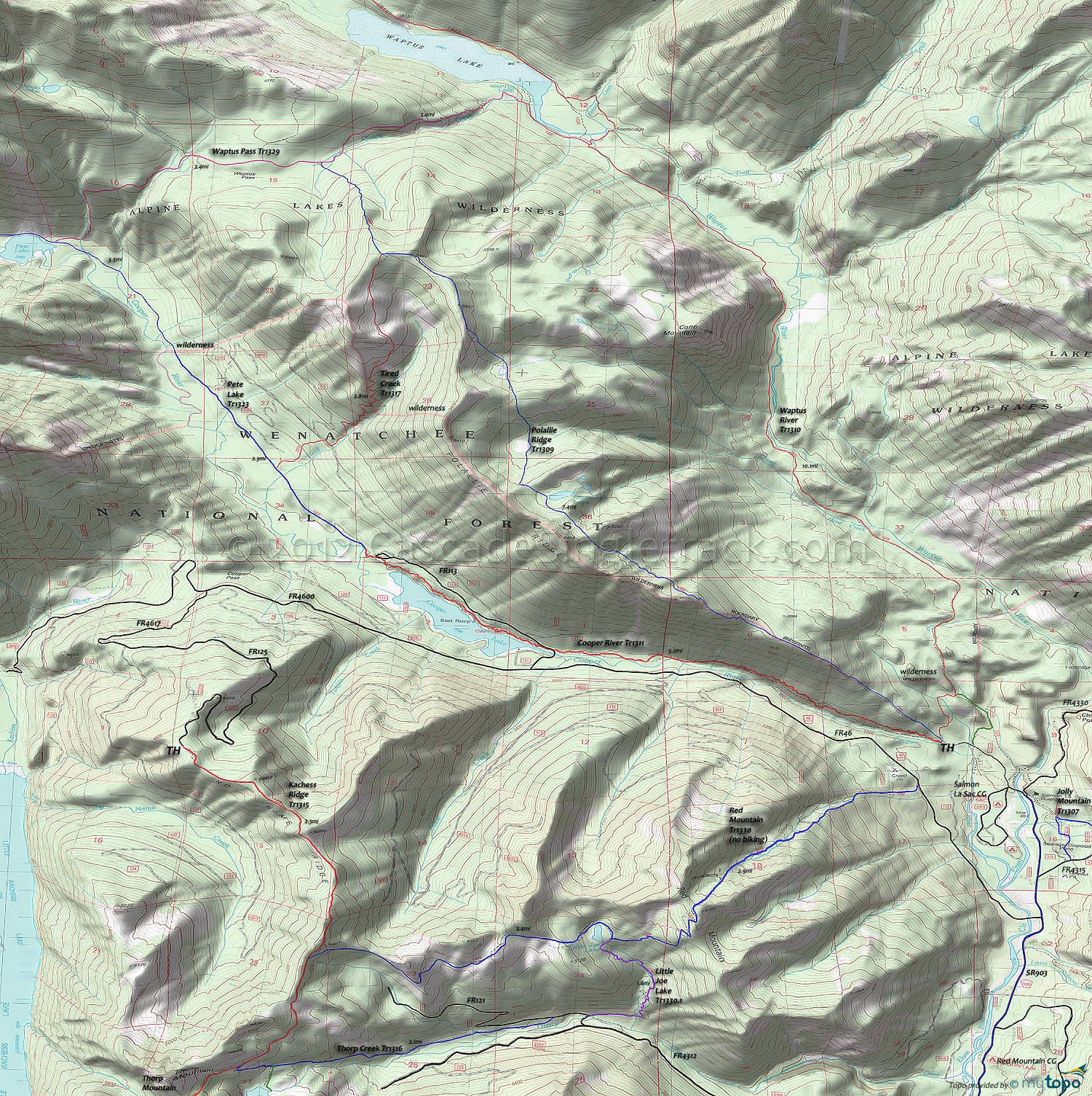
Cooper River Trail 1311 and Waptus River Trail 1310 Area Mountain Biking and Hiking Topo Map
Map includes: Cooper River Trail 1311, Kachess Ridge Trail 1315, Pete Lake Trail 1323 Mountain Biking and Hiking Trails.
Alpine Lakes Wilderness Hiking: Polallie Ridge Trail 1309, Red Mountain Trail 1330, Tired Creek Trail 1317, Waptus River Trail 1310.
TH: The Cooper River Trail 1311 ride starts with a steep 1.6mi Polallie Ridge traverse, with a short break in the ascent at .7mi. Cross a small creek at 2mi.
3.2mi: Cross FR113 and ride alongside the lake, passing the Owhi campground at 3.8mi.
5.2mi: At the end of the lake, cross FR113 and ride to the Pete Lake Tr1323 intersection. Pete Lake Tr1323 continues for 2.4mi to the wilderness boundary. Avoid on weekends or when there are a lot of people in the area, to help prevent user conflicts.
Draggable map: Map window adjusts to screen size and will respond to touch control. Use scrollbar for mouse control.
No Map? Browser settings and some browser extensions can prevent the maps from appearing. Please see Site Tech


