
Red Devil Trail 1221 and Red Hill Trail 1223 Area Mountain Biking and Hiking Topo Map
Map includes: Red Devil Trail 1221, Red Hill Trail 1223, Red Hill Spur Trail 1223.1, Tronsen Ridge Trail 1204 Mountain Biking and Hiking Trails.
TH: From the lower Devils Gulch, Mission Ridge Tr1201 TH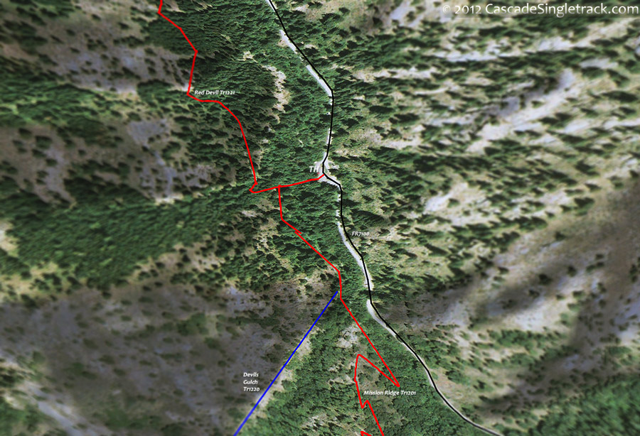
View of the Mission Ridge TH, ride to the T intersection and go right onto Red Devil Tr1221. Traverse the hillside drainages, crossing a creek at 1mi and 2.4mi. After a sharp switchback at 3.3mi, descend to a creek crossing at 3.9mi, then descend to the Red Hill Tr1223 intersection.
5.2mi: Go left onto Red Hill Tr1223, with a 1.2mi, steep but steady switchback ascent to the sloping ridgeline starting at 5.9mi, requiring some hike-a-bike. Strong climbers should be able to manage the ridgeline ascent, but the sustained climbing of the sloping ridgeline may require some hike-a-bike for intermediate riders.
7.7mi: Cross the forest road, followed by a few switchbacks then pass the FR7104 intersection at 8mi. Ride alongside FR7104 to the Red Hill Spur Tr1223.1 intersection, with a break in the ascent at 8.6mi.
9.5mi: Climb to a saddle and go left onto Red Hill Spur Tr1223.1, with a brief climb to the ride summit at 9.8mi, as the trail bends sharply around a ridgetop. Descend the steep ridgeline slope to a switchback at 10.7mi, leading to the steepest descent of the ride.
12.8mi: Go left onto Devils Gulch Tr1220 and continue the descent to the Mission Ridge Tr1201 intersection, then go left and ride to the TH.

Draggable map: Map window adjusts to screen size and will respond to touch control. Use scrollbar for mouse control.
No Map? Browser settings and some browser extensions can prevent the maps from appearing. Please see Site Tech

