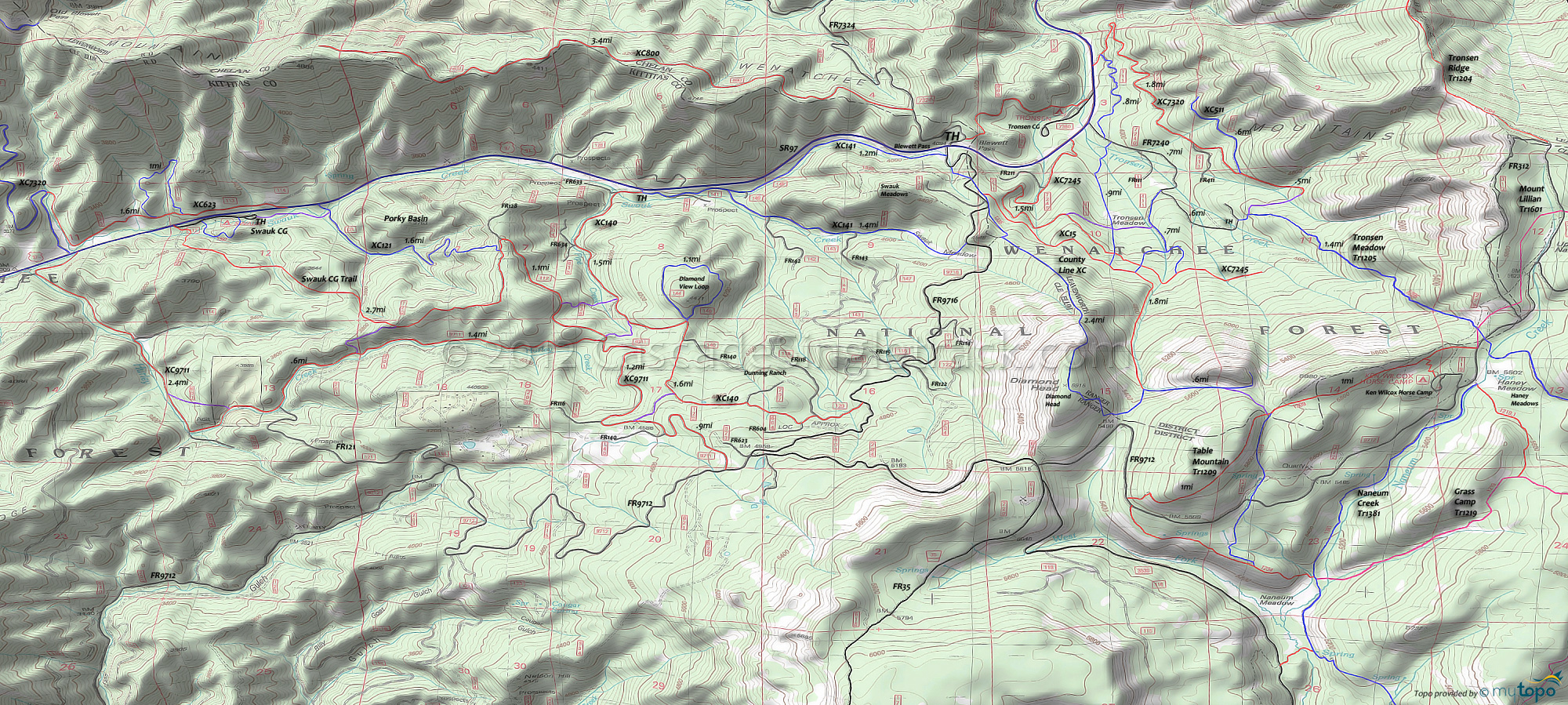
Blewett Pass XC Ski Trails Area Topo Map
Map inlcudes: County Line, XC-006 Swauk Sno Park, XC-15, XC-111, XC-121, XC-140, XC-141, XC-623, XC-800, XC-7245, XC-7320 and XC-9715 Blewett Pass XC Ski Trails.
TH: Ascend County Line to Diamond Head then descend on XC-15. County Line starts at the first FR9716 corner, passing the Discovery TH on the left then ascending the slope alongside the creek (on the right side of the gully) then crossing FR9716.
.1mi: Cross FR9716 at the XC-15 TH and go on XC-15 for 0.5mi. At a crest, go 100' south on XC-141 (don't descend) then ascend County Line to Diamond Point.
1.8mi: After a 1700' ascent, pass the Diamond Head summit and begin the descent past FR9712 at the 2.2mi Spruce Pass, reaching the XC-15 intersection. If snow conditions are good, it's possible to ski the west face of Diamond Head, to FR9716. This is not drawn on the topo map, as the route varies. The groomed FR9712 and FR35 can provide a bailout option back to Blewett Pass, if snow conditions are not good.
2.4mi: Go left onto XC-15 and descend Windy Gully, along a tributary of Tronsen Creek. Watch for avalanche hazards in this area.
3.3mi: After bearing left, away from the creek, pass several connector trails on the right while paralleling XC-7245.
4.3mi: Bear right at the (previously visited) intersection with County Line and ski downhill to the TH.
Draggable map: Map window adjusts to screen size and will respond to touch control. Use scrollbar for mouse control.
No Map? Browser settings and some browser extensions can prevent the maps from appearing. Please see Site Tech


