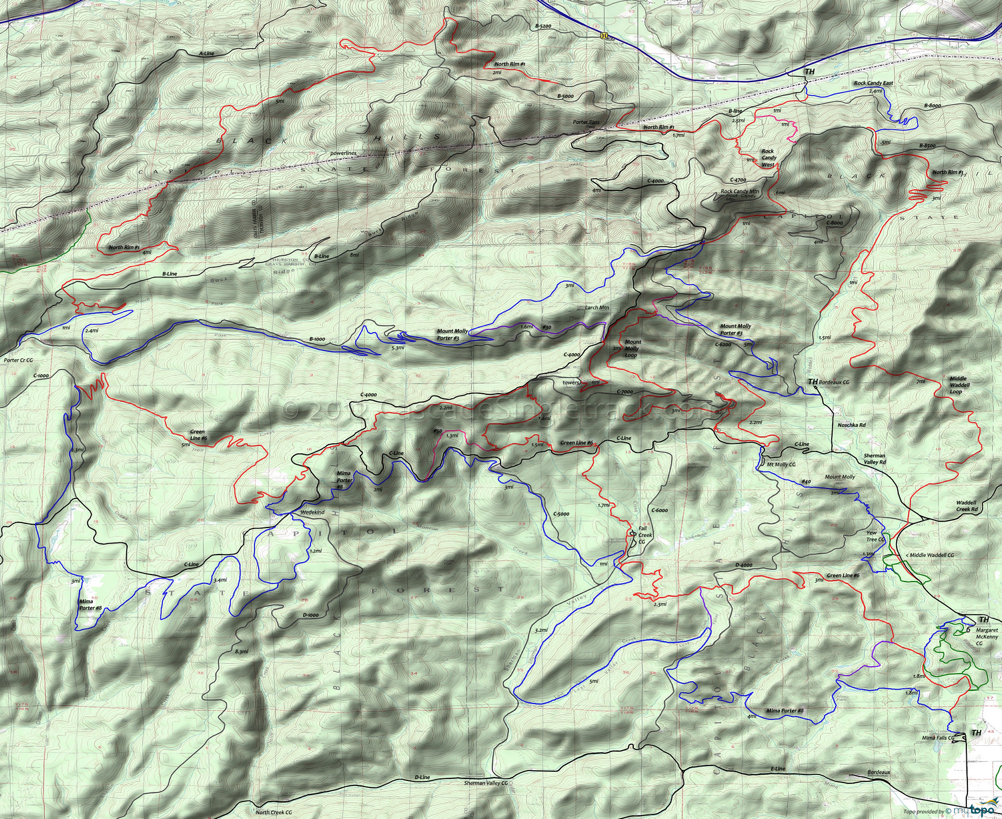
Capitol Forest Area Mountain Biking and Hiking Topo Map
Map includes: Green Line Trail 6, Mima Porter Trail 8, Mount Molly Trail 40, North Rim Trail 1, Rock Candy East Trail and Waddell Loop Trail Mountain Biking and Hiking Trails
TH: Ascend Mt Molly Tr40 from the Middle Waddell TH, around the CG and across Waddell Creek. At 1mi, go left at the fork (Yew Tree CG). Cross D-4800 at 1.4mi, and ascend to Mt Molly, crossing a doubletrack at 1.9mi.
2.8mi: Summit Mt Molly then cross D-4900.
3.3mi: Cross D-4000 then pass the Mt Molly CG. Pass several side trails to the CG then at 4.1mi go left onto C-Line.
5.7mi: Cross Fall Creek on C-Line, then go left onto Green Line Tr6 and descend the steep slope to the Fall Creek CG at 7.4mi. Logging on this slope requires some pathfinding. While crossing the clearcut, dogleg left at the logging road to rejoin the trail, then once back in the woods, dogleg to the right on C-5200 at 6.8mi.
7.8mi: Past the Fall Cr CG, cross C-6000 and ascend the steep switchbacks to D-4000, passing the Mima Porter Tr20 intersection at 9.9mi, near the Lost Valley Creek headwaters. Parallel then cross D-4600 at 11.1mi, then descend the steep slope past the 13.1mi Mima Falls Tr10 intersection.
13.5mi: Go left onto Green Line Tr6A and ride through various Waddell Loop intersections near the Margaret McKenny CG, to Waddell Cr Rd and back to the TH.
Draggable map: Map window adjusts to screen size and will respond to touch control. Use scrollbar for mouse control.
No Map? Browser settings and some browser extensions can prevent the maps from appearing. Please see Site Tech


